
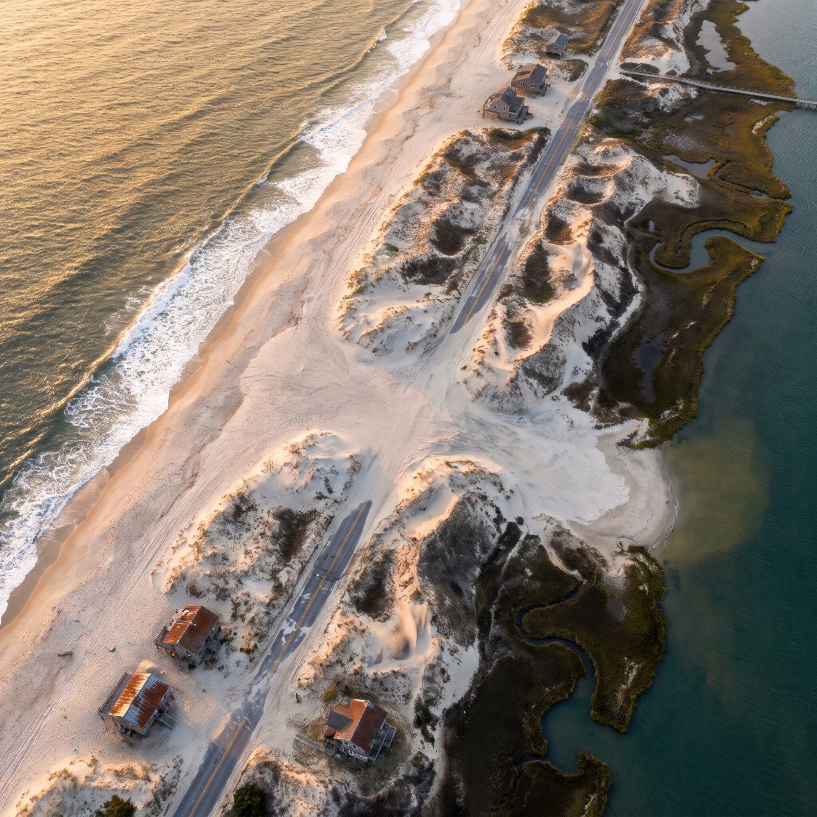
The ground under Hatteras is in motion. Not fast enough to watch, but fast enough that a lighthouse built on dry land in 1870 was nearly in the surf by 1980. The Outer Banks are a thin ribbon of sand with the Atlantic shoving on one side and Pamlico Sound filling in behind. Inlets open in a single night and close over a century. Old forests surface on the beach as blackened stumps. We keep paving a road the sea keeps erasing. Here’s the slow, strange geology behind a coastline that refuses to stay where we put it.
19. The Islands Are Slowly Walking Toward the Mainland
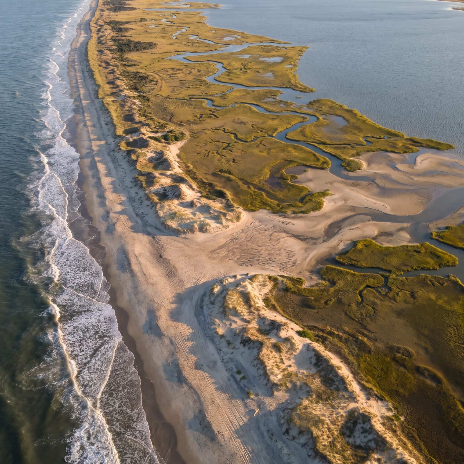
Here’s the part that breaks people’s brains. The Outer Banks aren’t eroding away so much as moving — the whole island system is rolling landward, slowly, over centuries. Sand washes across the ocean side during storms while marshes creep outward along the back. Yale Environment 360, citing a federal study, describes exactly this slow landward crawl.
The National Park Service says erosion, overwash and shifting inlets all still shape Cape Hatteras National Seashore today. And if sea level climbs far enough, an NPS geologic report warns the islands could hit a tipping point: faster migration, more breaching, smaller islands, maybe submergence.
18. Ancient Tree Stumps and Marsh Peat Rising on the Ocean Beach at Ocracoke
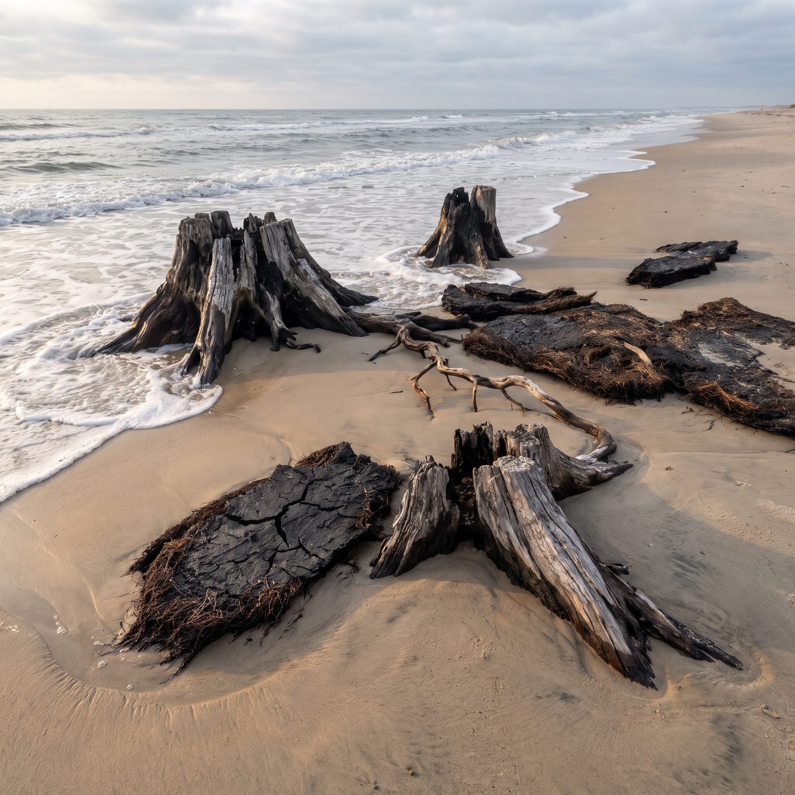
Walk Ocracoke’s beach after the right storm and you might find a dead forest sticking out of the surf. Black stumps. Slabs of peat. It looks like something went wrong, and nothing did.
An ECU geology handout explains that old inlet sediments usually sit buried under marsh peat and storm overwash, and that peat can surface right on the shoreface. The Ocracoke Island Journal calls it the “leap frog” idea: storm tides erode ocean-side sand, and the wind carries it across the island and onto the sound-side marsh. Centuries later, as the island keeps migrating landward, that buried marsh — stumps and all — emerges on the ocean side. You’re looking at the back of the island reappearing on its front.
17. Oregon Inlet, Marching South About 100 Feet a Year Since 1846
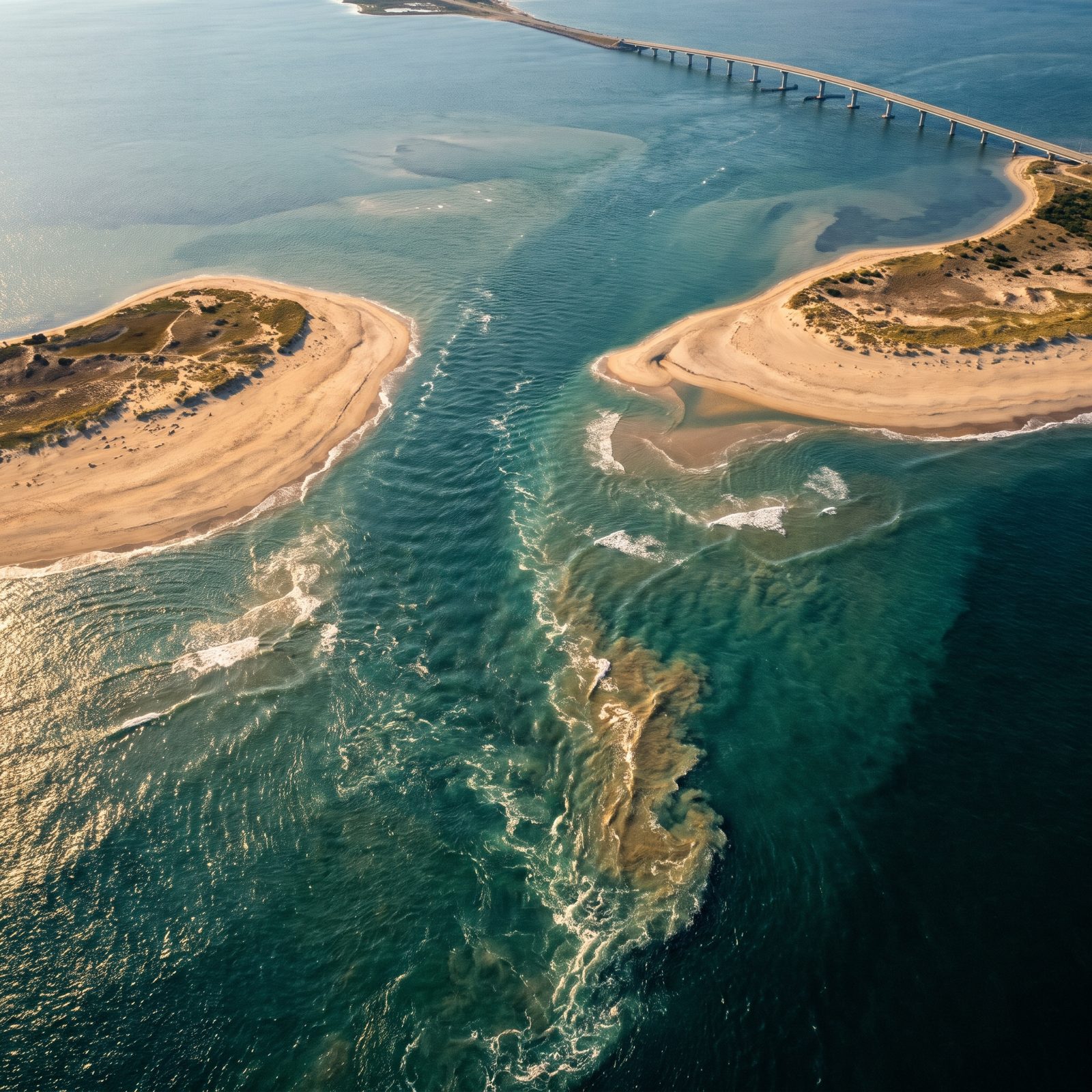
A hurricane punched Oregon Inlet open in 1846, and it has been drifting south ever since — at a long-term average of roughly 100 feet a year, according to a 2006 Virginian-Pilot article.
Think about what that does to anything built nearby. The old Oregon Inlet Coast Guard station was completely abandoned by 1988 because the migrating inlet threatened to swallow it. Bodie Island Lighthouse once stood right at the inlet’s edge; it now sits about three miles away. The lighthouse didn’t move. The inlet did.
16. The Marc Basnight Bridge: Nine Spans Guessing Where the Channel Will Be
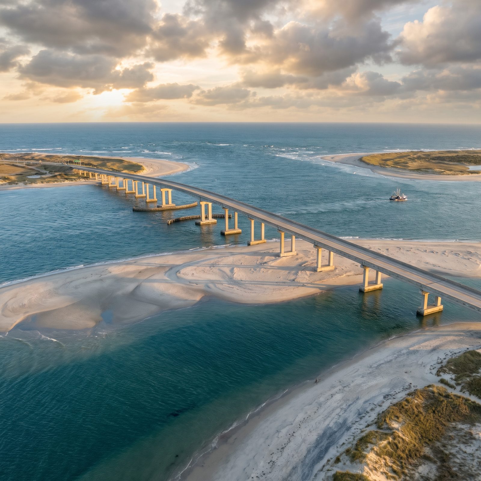
You can’t anchor a bridge to a channel that keeps moving, so engineers did the next best thing and built one that stays flexible.
The Marc Basnight Bridge replaced the old Bonner Bridge, which, per designer HDR, suffered scour and deterioration for more than 50 years after opening in 1963. The replacement’s 3,550-foot main section includes nine 350-foot spans. The clever bit: any one of those nine spans can sit over the navigation channel as it wanders through the inlet.
Does it work? Mostly. In May 2022 the Army Corps reported part of the marked federal channel beside the bridge had shoaled in to just two or three feet deep, and most boats couldn’t get through. The water moves faster than the dredges.
15. Moving the Cape Hatteras Lighthouse 2,900 Feet in 23 Days
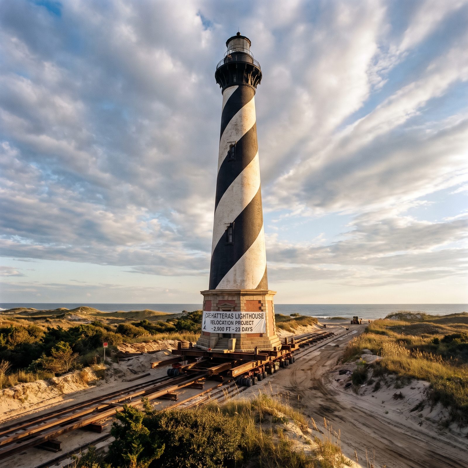
In 1870 they built it on dry, safe ground. By 1980 the sea was 50 to 70 feet away.
So in the summer of 1999, crews did something that sounds impossible: they picked up the entire 200-foot, 4,800-ton brick lighthouse and rolled it 2,900 feet to the southwest, away from the eroding shore. Coastal Review dates the start to June 17, 1999, and the whole move took 23 days. The keepers’ quarters, oil house and cisterns went first, then the tower itself, inching along on steel rails and hydraulic jacks.
The payoff: NPS says the move put the lighthouse 1,500 feet back from the ocean. It bought the tower time, not permanence. On the Outer Banks, those are different things.
14. Isabel Inlet: The 1,700-Foot Gap Hatteras Island Didn’t Ask For
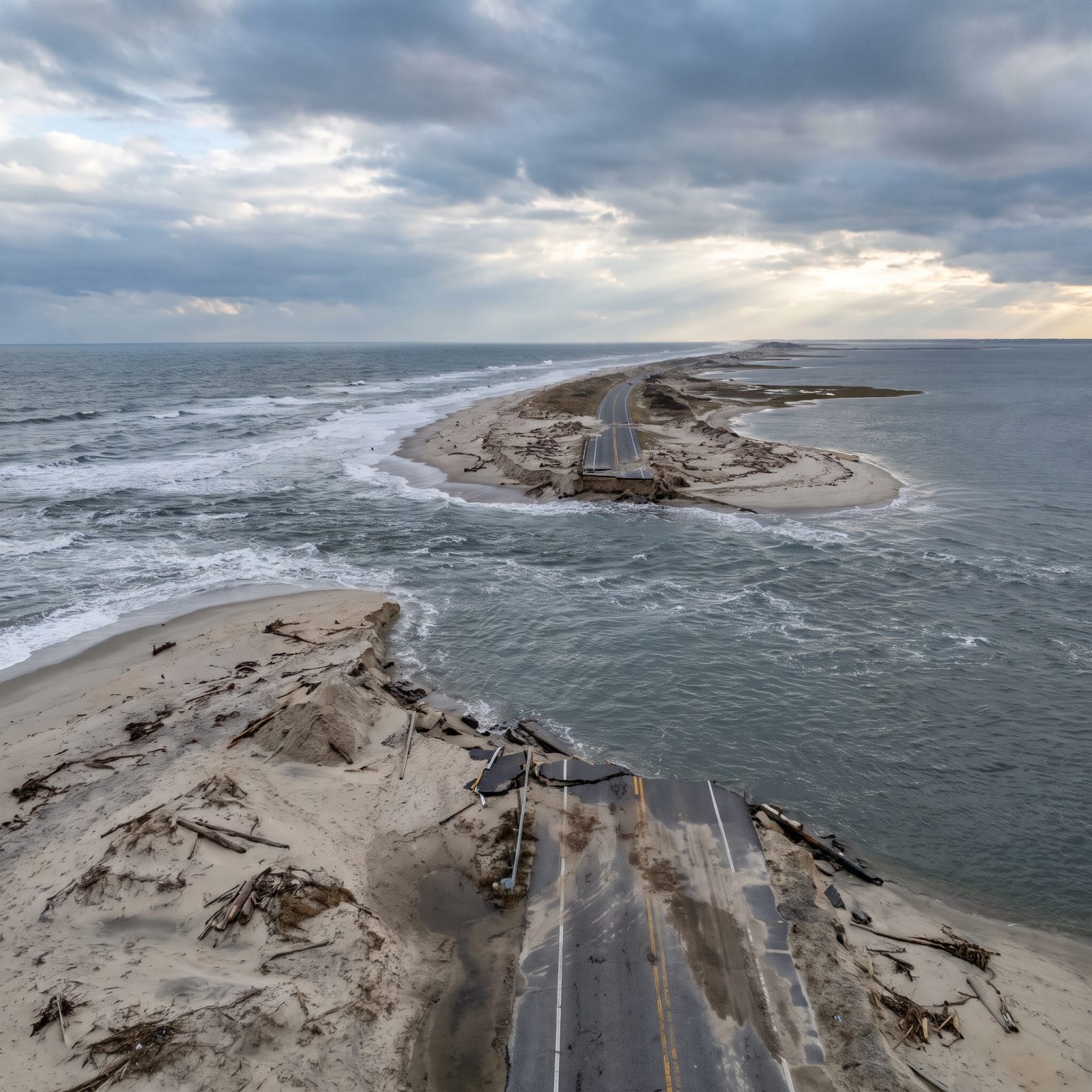
In 2003, Hurricane Isabel found the narrowest part of Hatteras Island and tore straight through it. Locals named the gap Isabel Inlet.
The NC State Climate Office puts it at about 1,700 feet wide. It took out a chunk of Highway 12 and left Hatteras Village cut off from the rest of the state, reachable only by boat. The Army Corps filled the breach with sand dredged from the ferry channel, and Highway 12 reopened November 22, roughly two months after the storm.
13. New Inlet on Pea Island: The Gap That Opened, Closed, Then Opened Again
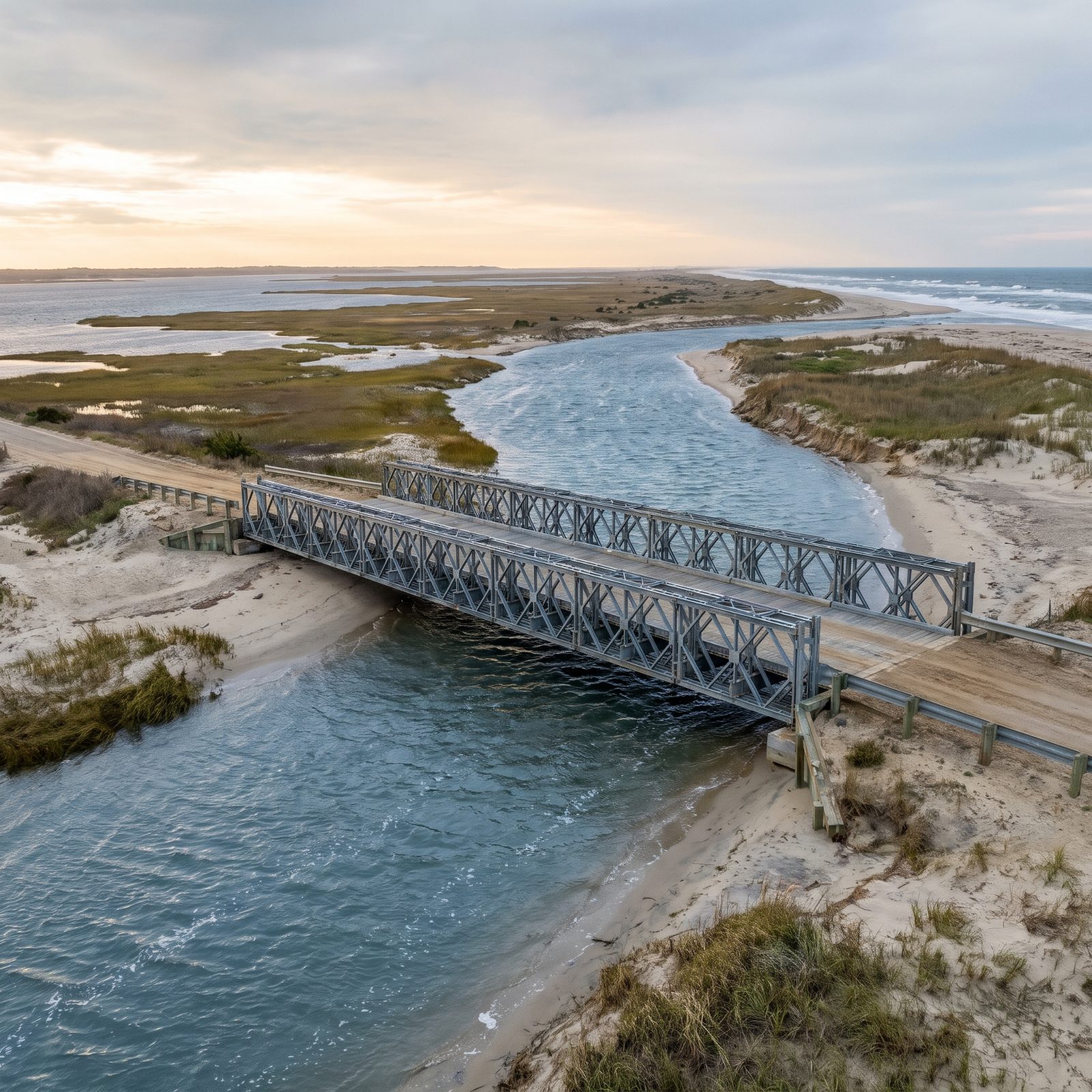
Some inlets can’t make up their minds. New Inlet on Pea Island is the poster child.
The state bridged it in the mid-1930s. By 1952 it had mostly closed on its own, so NC 12 was paved straight across, and the problem was solved for about six decades. Then in August 2011, Hurricane Irene’s surge punched a fresh channel roughly 200 feet wide at the same spot, plus a smaller breach just north of Rodanthe.
Modular steel truss spans like the one pictured, fed at both ends by a sand road lined with metal guardrails, can go up fast in the dunes; NC 12’s own temporary span, nicknamed the “Lego Bridge,” opened that October. The permanent replacement, later named for lifesaver Richard Etheridge, opened in November 2017. The island has reopened the same door more than once.
12. The Ash Wednesday Storm Breach That Keeps Threatening Buxton
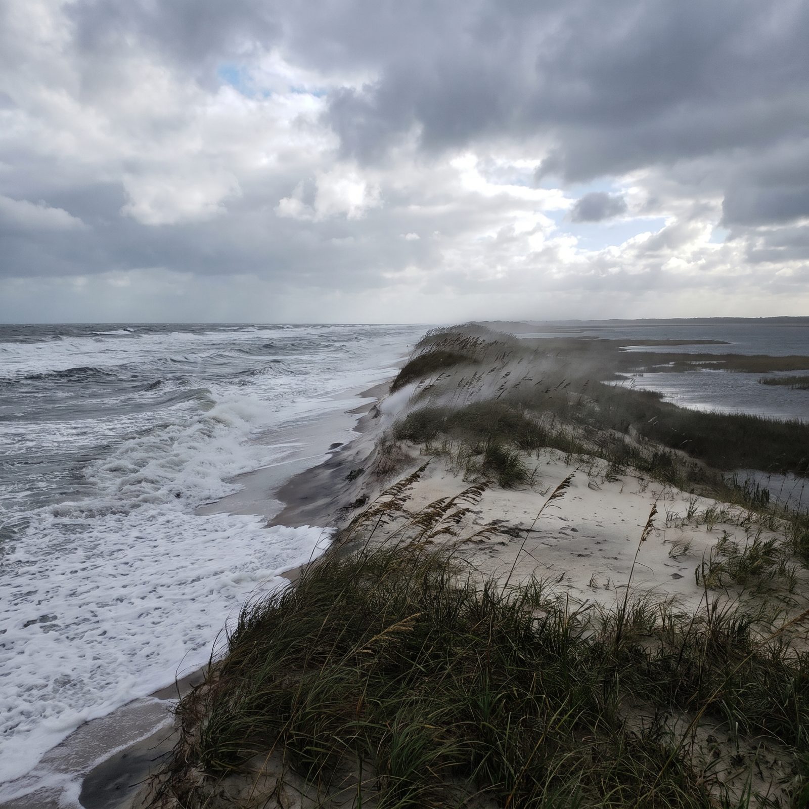
The powerful Ash Wednesday nor’easter of 1962 opened an inlet near Buxton, according to an ECU geology handout. A bridge went up over the new gap. Then another nor’easter that December destroyed the bridge, and the Army Corps filled the inlet back in with dredged sand.
Here’s the uneasy footnote: that same handout says the island at Buxton keeps getting narrower and could breach again. The 1962 storm wasn’t a fluke. It was a preview.
11. The Lost Inlets of the Northern Banks That Freshened Currituck Sound
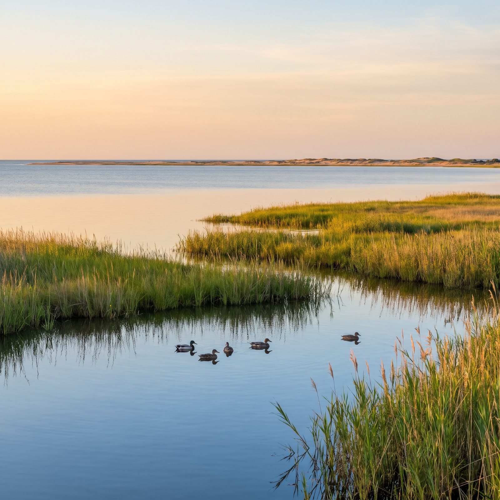
Look at a map of the northern Outer Banks today and something’s missing: inlets. There aren’t any north of Oregon Inlet, and there haven’t been since 1846, per the local guide Carolina Designs.
It wasn’t always that way. NCpedia records that Currituck, Roanoke and old Hatteras inlets all grew unreliable in the early 1700s and had closed by late century. Roanoke Inlet mattered enough that people tried, and failed, to reopen it. When Currituck Inlet finally sealed for good, it left no navigable passage between Virginia and Ocracoke Inlet.
The closing had a strange upside. Cut off from the sea, Currituck Sound turned from brackish to fresh, and that freshwater marsh became prime winter waterfowl habitat. A geologic accident built a flyway.
10. Jockey’s Ridge, the 100-Foot Dune That Walks Toward the Houses
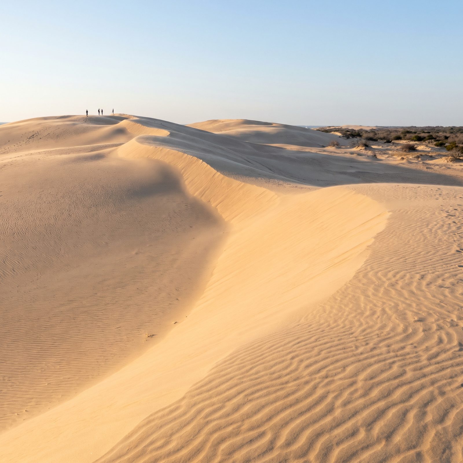
NC State Parks calls Jockey’s Ridge the tallest living natural sand dune system in the eastern United States. Its height swings between 80 and 100 feet depending on how the wind has been behaving lately.
And it travels. Northeast winds in winter and southwest winds in summer push the sand back and forth, with damp sand just under the surface holding the whole mass loosely together. The AP, citing the Virginian-Pilot, reported the dune usually creeps about six feet a year. In one bad year it jumped roughly 30 feet in places, drifting toward nearby homes, and the park had to truck sand away to keep the dune from burying the neighborhood.
9. Kill Devil Hill, the Dune the Wright Brothers Watched Walk Away
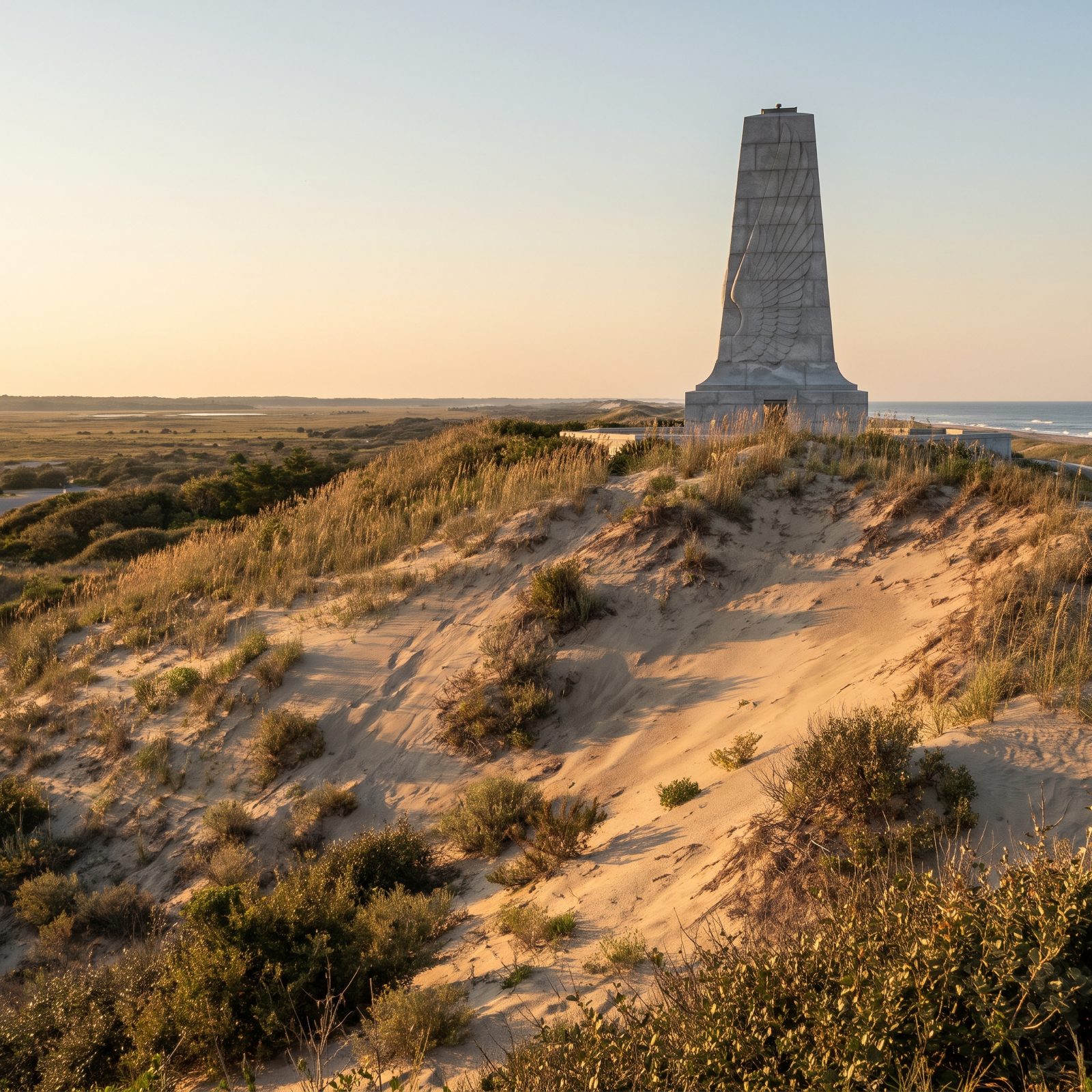
The hill the Wright brothers launched from would not stay put. After 1903, NPS records show prevailing winds shoved Kill Devil Hill well to the southwest, sand walking downwind one grain at a time.
You cannot build a granite monument on a dune that migrates. So in 1928 the Coast Guard and locals started planting shrubs and grass to pin it down, and the work was done by 1931, before the monument ever went up. Today a 60-foot granite shaft stands on a 90-foot dune held in place with special grasses.
8. The Depression-Era Dune Line Built by 1,500 Men With Fences
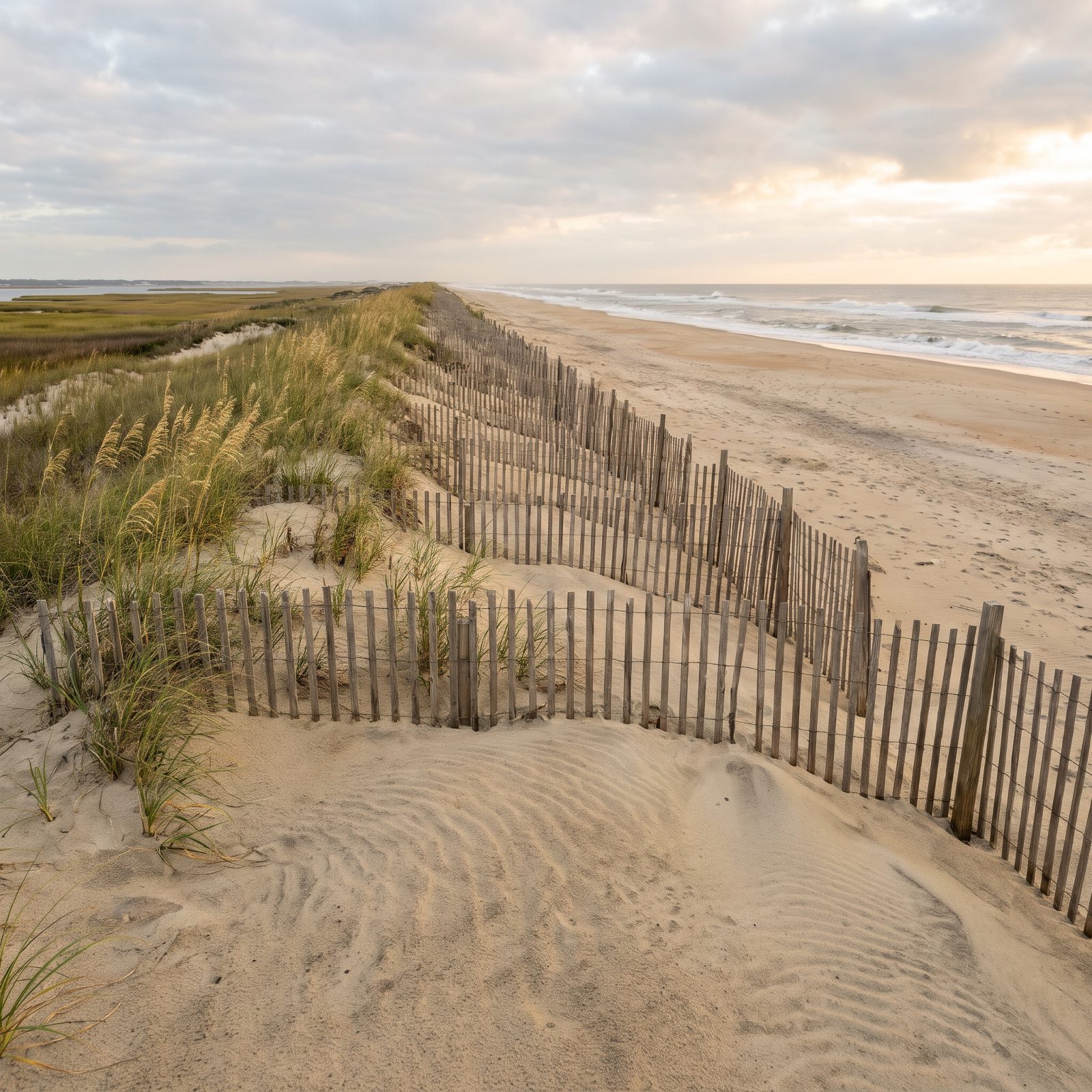
A wall of sand built by hand during the worst economy in American history. The WPA, working alongside the National Park Service, ran a project to raise a line of man-made, vegetated dunes held together with fences. Somewhere around 1,500 WPA and Civilian Conservation Corps workers drove those fences, living in camps on Cape Hatteras and Roanoke Island.
Beach grass, sea oats, cordgrass, wire grass, shrubs, tree seedlings — they planted all of it. The dunes climbed 10 to 25 feet. And for the last few decades, storms have been grinding them right back down. Turns out you can build a barrier to stop islands from doing exactly what barrier islands do, which is move, but the islands tend to win.
7. The Beach Houses Dropping Into the Atlantic at Rodanthe and Buxton
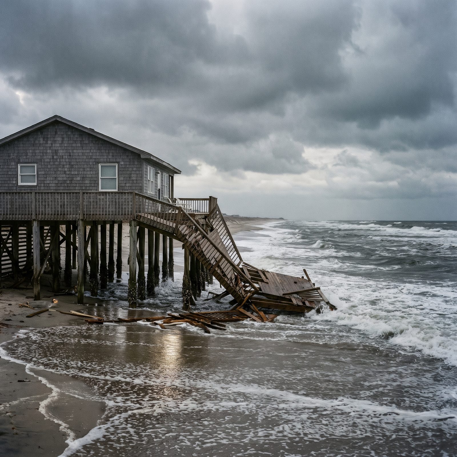
You have seen the videos. A beach house leaning, then gone, boards floating out on the surf. Fox Weather reported in June 2026 that dozens of houses on Cape Hatteras National Seashore had fallen into the ocean since 2020, including a June 2, 2026 collapse in Buxton, the 20th there since September 2025.
One house on East Corbina Drive in Rodanthe went down on August 16, 2024, and the Seashore said its debris spread miles north. Yale E360 cites NPS estimates that parts of Rodanthe have lost more than 200 feet of shoreline in two decades. Do the arithmetic and that is roughly a car length of beach gone every year. The beach did not come to the house. The house stood still while the beach left.
6. The Rodanthe Jug Handle Bridge, Built Out Into Pamlico Sound
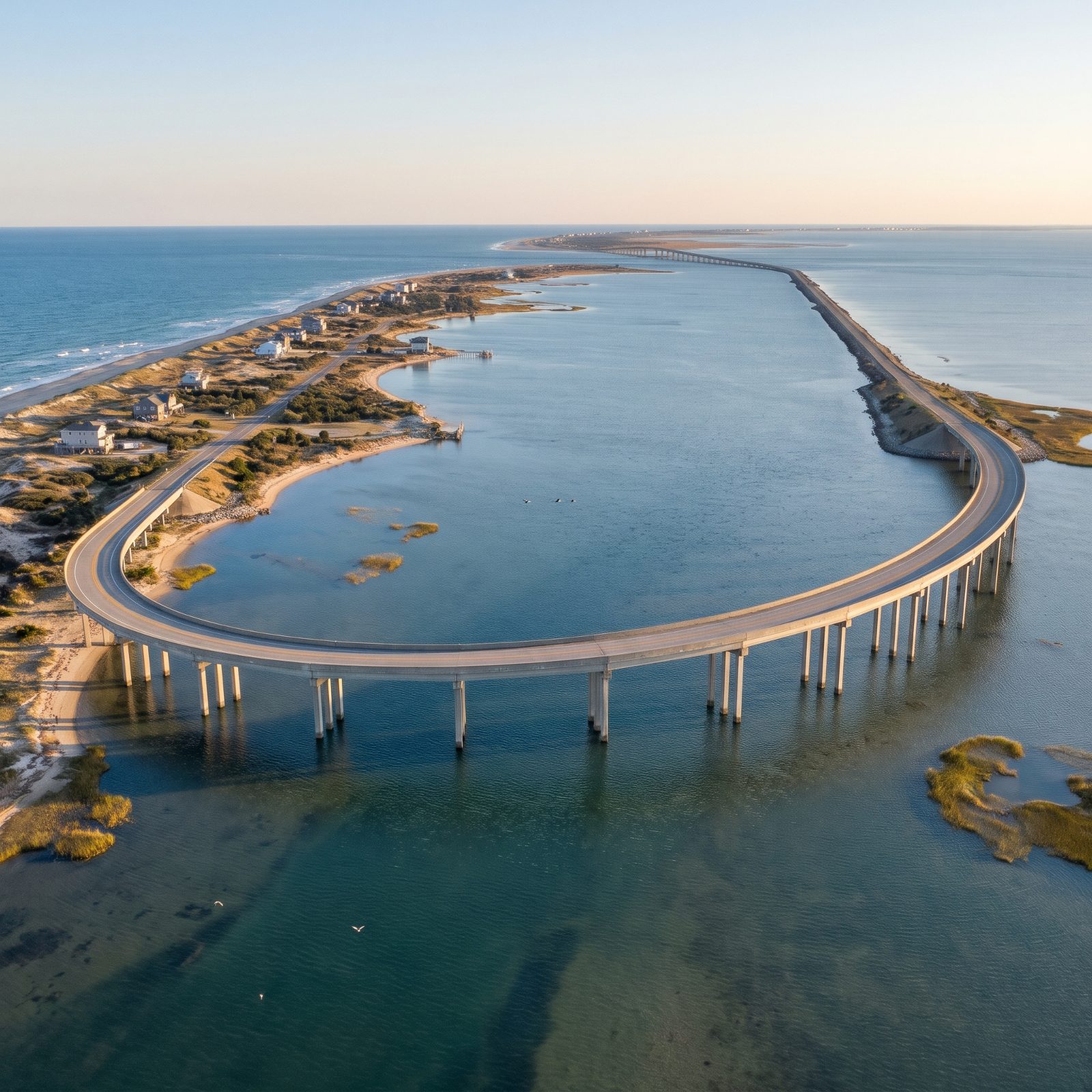
When a stretch of road keeps flooding and washing out, you stop fighting the ocean and drive around it. The 2.4-mile Rodanthe jug handle bridge opened to traffic on July 28, 2022, swinging NC 12 out over Pamlico Sound to skip the notorious S-Curves in northern Rodanthe.
That old stretch flooded with ocean overwash constantly. Instead of patching it forever, the state built out over open water — more than $145 million, with construction beginning in 2018. The road retreated from the Atlantic the only way a road can. It left the island.
5. Highway 12 on Pea Island, a Road That Keeps Moving the Dirt
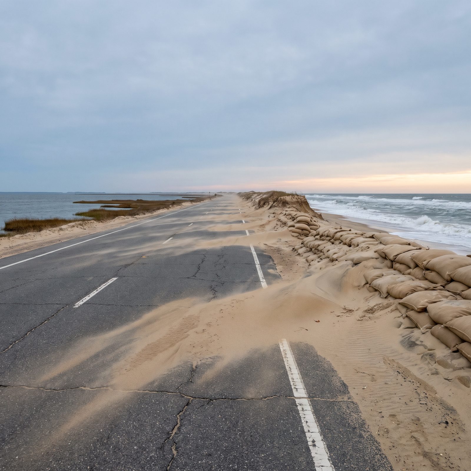
Picture the only road connecting Hatteras Island to the mainland, laid across a strip of sand that is actively trying to wash out from under it.
In December 2024 the Coastal Resources Commission approved NCDOT’s request to repair 1,300 feet of dune and install 1,100 feet of sandbags near the Pea Island National Wildlife Refuge visitor center, where the erosion has been brutal. NCDOT landed roughly $1.865 million in federal PROTECT funds for its SAND Plan, which studies the 11 miles between the Marc Basnight and Jug Handle bridges, with alternatives that include building bridge sections in Pamlico Sound or along the existing corridor.
4. Hurricane Dorian’s Seven Feet of Overwash Across Ocracoke
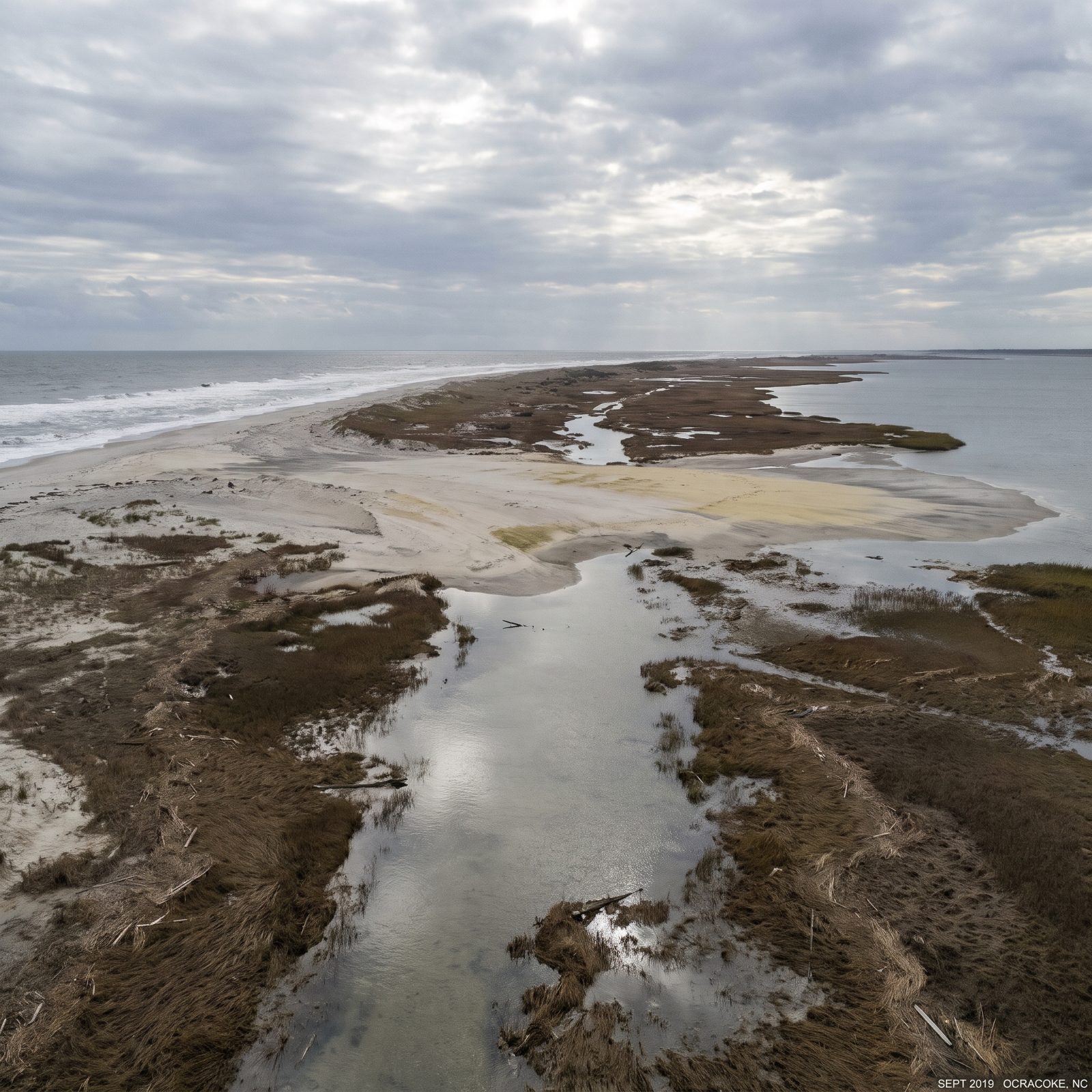
Ocracoke got buried from the wrong direction. Island Free Press reports Hurricane Dorian pushed roughly seven feet of storm surge into the village in 2019 and shut the island down for nearly three months.
A National Park Service report, with photos dated September 16, 2019, documented an overwash area and a breach at the island’s north end, finding both accretion and erosion along the shore. That detail matters more than it sounds. The sand was not simply lost to the sea, it was relocated. Overwash is how a barrier island feeds itself, hauling sand from the ocean face and laying it down toward the sound, raising and widening the back of the island while the front retreats.
3. Why the Sea Rises Faster North of Cape Hatteras at Duck

Not every stretch of this coast is sinking at the same rate, and Cape Hatteras marks the dividing line.
The NC Coastal Resources Commission Science Panel’s 2015 update projects 2045 sea-level rise from about 2.4 inches at Southport up to roughly 5.4 inches at Duck — more than double the rate across a single state’s coastline. The report pins that extra water, mostly north of Cape Hatteras, on the speed and position of the Gulf Stream. Kopp and colleagues found that from 1980 to 2010, local rise south of the cape held steady or even slowed near Beaufort, while sites to the north sped up.
2. The 1985 Rule That Banned Seawalls on North Carolina’s Oceanfront
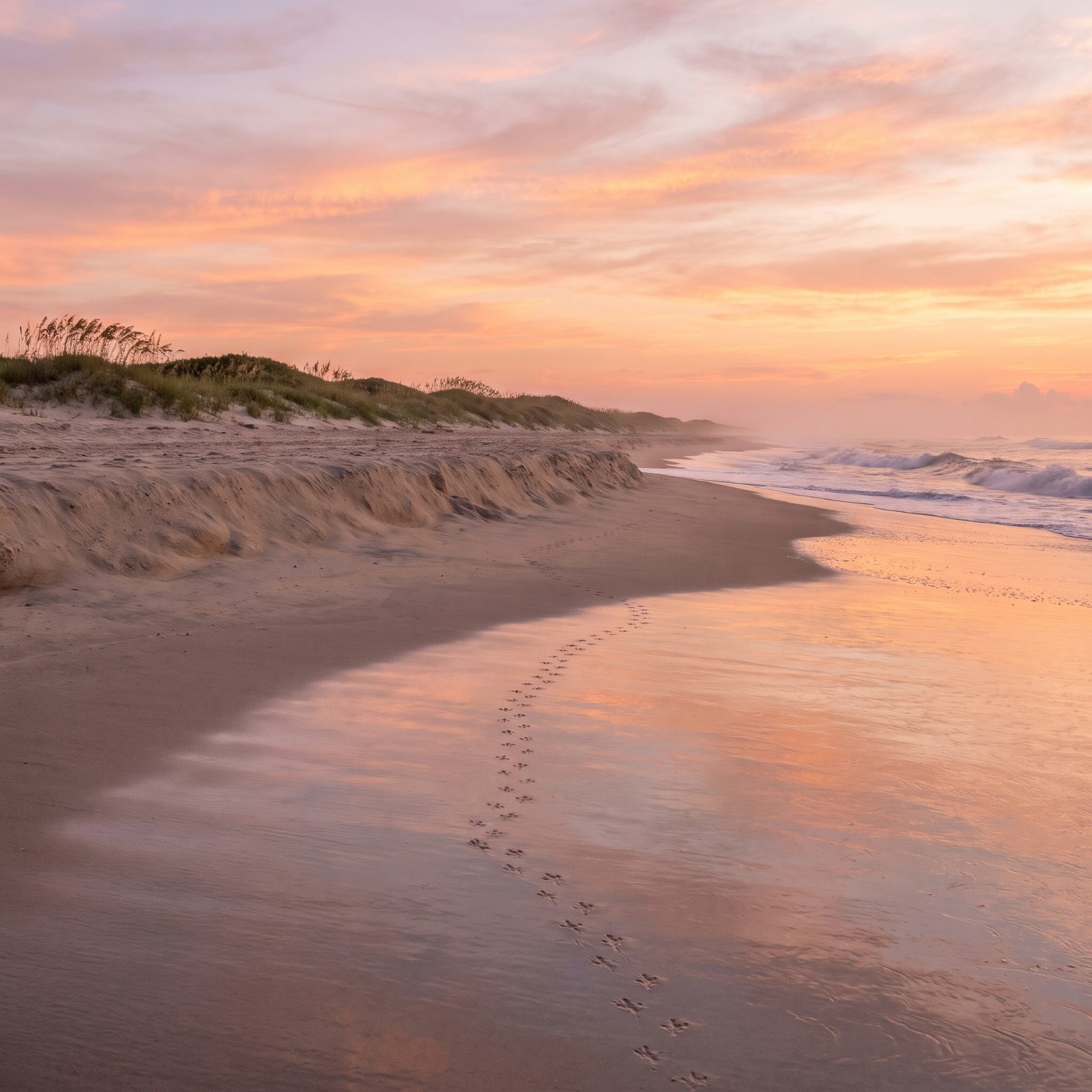
Decades ago, North Carolina decided it would not armor its beaches. That one choice is why they still look the way they do.
In January 1985 the Coastal Resources Commission banned hardened erosion-control structures on the oceanfront, after studying what seawalls had done to beaches in other states. The NC Coastal Federation notes it became a regulatory rule in 1985 and state law in 2003. A handful of narrow exceptions followed: a 1989 change for the Bonner Bridge, and in 2011 Senate Bill 110 allowed up to four test terminal groins.
Here is the logic most people miss. A seawall saves the house behind it and starves the beach in front of it, because the sand that would have fed the shore has nowhere to go. You keep the building and lose the beach. North Carolina chose the beach.
1. Building Setbacks Measured by How Fast the Beach Disappears
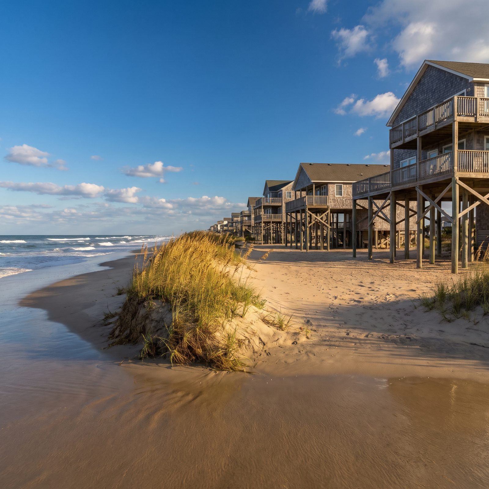
How far back you can build depends entirely on how fast that exact stretch of sand is vanishing.
NC DEQ bases oceanfront setbacks on long-term average annual erosion rates. Back in 1979, under the Coastal Area Management Act, the Coastal Resources Commission first set up this erosion-rate-based way of siting oceanfront development, which is also used to set the boundaries of Ocean Erodible Areas of Environmental Concern. For buildings under 5,000 square feet, the setback is 60 feet or 30 times the erosion-rate factor, whichever is greater, and the commission approved updated factors on February 28, 2019.
So the rules themselves assume the beach is moving. The state does not pretend the shoreline is fixed — it measures the retreat, multiplies it out over a lifetime, and tells you to build behind where the water will be. The islands roll toward the mainland, and North Carolina wrote that fact straight into its permits.