
A dam doesn’t just block a river. It swallows a whole country that nobody photographs on the way down — canyons, temples, rapids, islands, flood-plain villages, waterfalls that had roared for ten thousand years. Then the maps forget them. We fed decades of survey records, old expedition sketches and geological data into AI models to rebuild these places as they looked the day before the concrete poured. Educated reconstructions, not photographs. But every canyon wall and rapid is grounded in what the record actually shows. Here’s the drowned world, back above the water line for a moment.
Please note that some of the images in this article were created with the assistance of AI.
45. The Colorado River Before Hoover and Glen Canyon Dams Tamed It
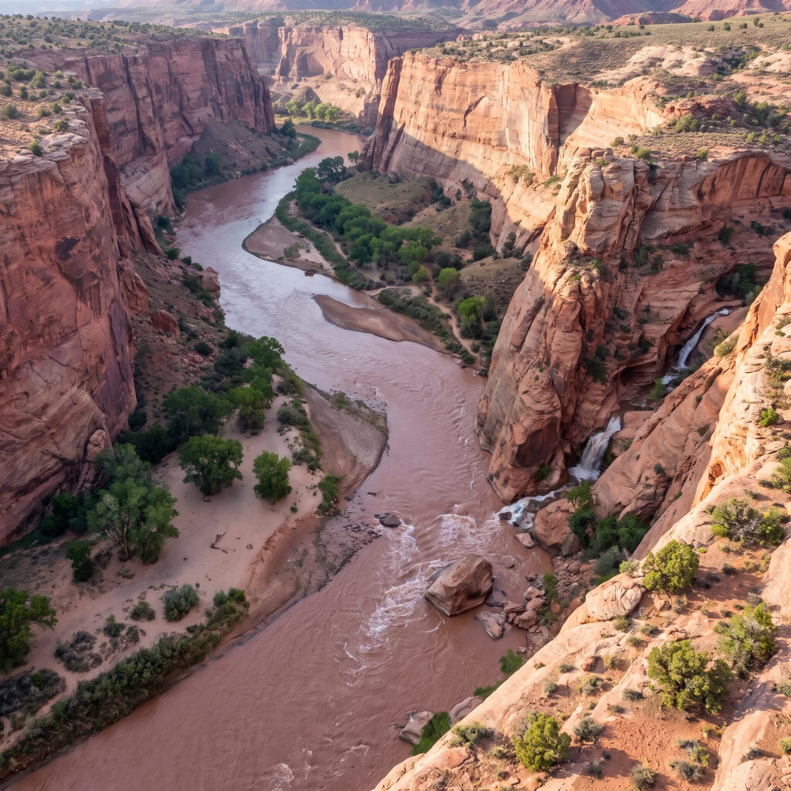
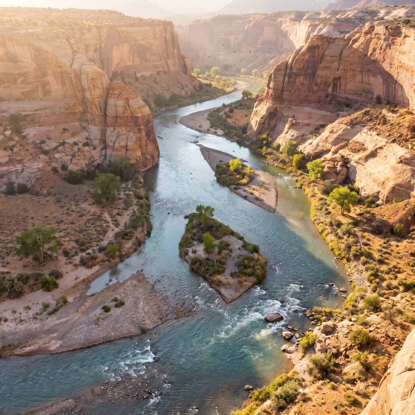
Glen Canyon was the one almost nobody saw. Before the dam gates closed in 1963, the Colorado ran red with the silt that gave it its name, carving side canyons, hanging gardens and sandstone grottoes that explorers called the most beautiful stretch on the river. Then Lake Powell filled over it.
The silt is the detail people miss. That reddish-brown water wasn’t pollution — it was the Grand Canyon being built, grain by grain, downstream. The dams trapped most of it. The river below runs cold and clear now, and the beaches it used to rebuild every year are slowly starving.
Recalling Glen Canyon before the gates closed, a veteran river guide who ran trips there from 1955 says “the one essential thing was it was so beautiful. So beautiful. To do what they did with it was a real travesty.”
44. The Nile Before the Aswan High Dam Stopped Its Flood
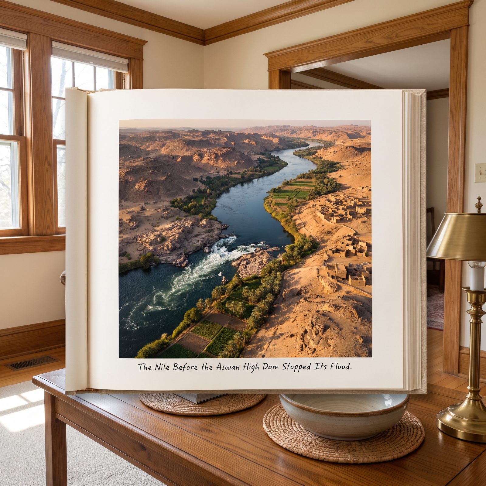
For five thousand years, the Nile flooded every summer, laid down black silt, and made the desert feed a civilization. The Aswan High Dam ended that cycle in 1970.
The famous cataracts are gone, drowned under Lake Nasser along with villages and temples. Egypt had to cut Abu Simbel into blocks and lift it uphill to save it from the water. The trade was real — no more catastrophic floods, year-round irrigation, electricity. But the silt that once fertilized the fields now settles in the reservoir instead, and farmers downstream buy fertilizer their great-grandfathers never needed. The Mediterranean delta, no longer fed, is quietly eroding into the sea.
43. The Yangtze Before the Three Gorges Dam Raised the Water 300 Feet
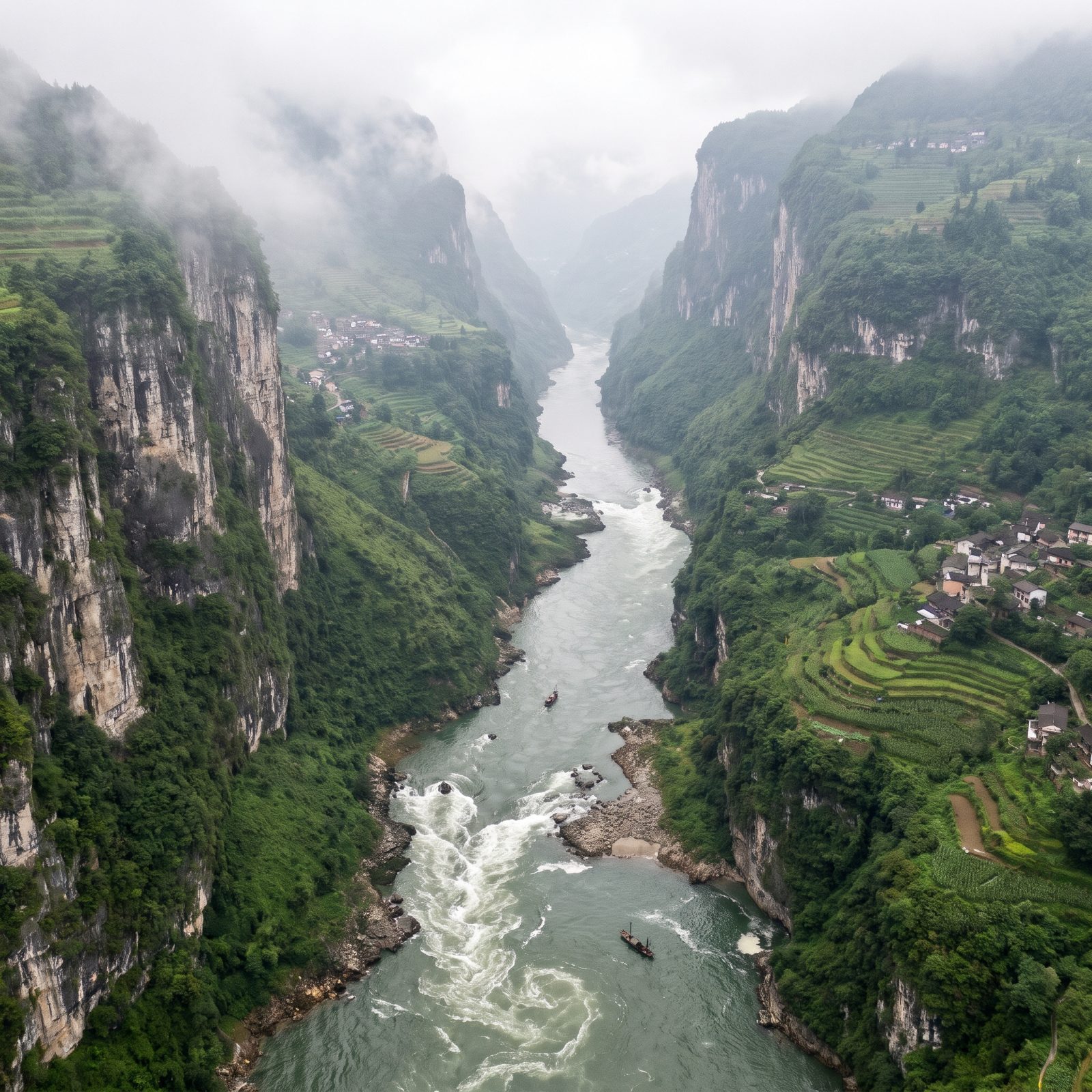
The Three Gorges were a gauntlet. For centuries boatmen feared the whirlpools and the shoals where the Yangtze squeezed between cliffs and turned violent — narrow channel, brutal current, the scenery behind a thousand classical poems.
The dam, finished in 2012, raised the water behind it by roughly 300 feet. Those shoals and rapids vanished. More than a million people moved, and whole towns, ancient carvings and archaeological sites went under.
42. The Zambezi Before Kariba Dam Created an Inland Sea
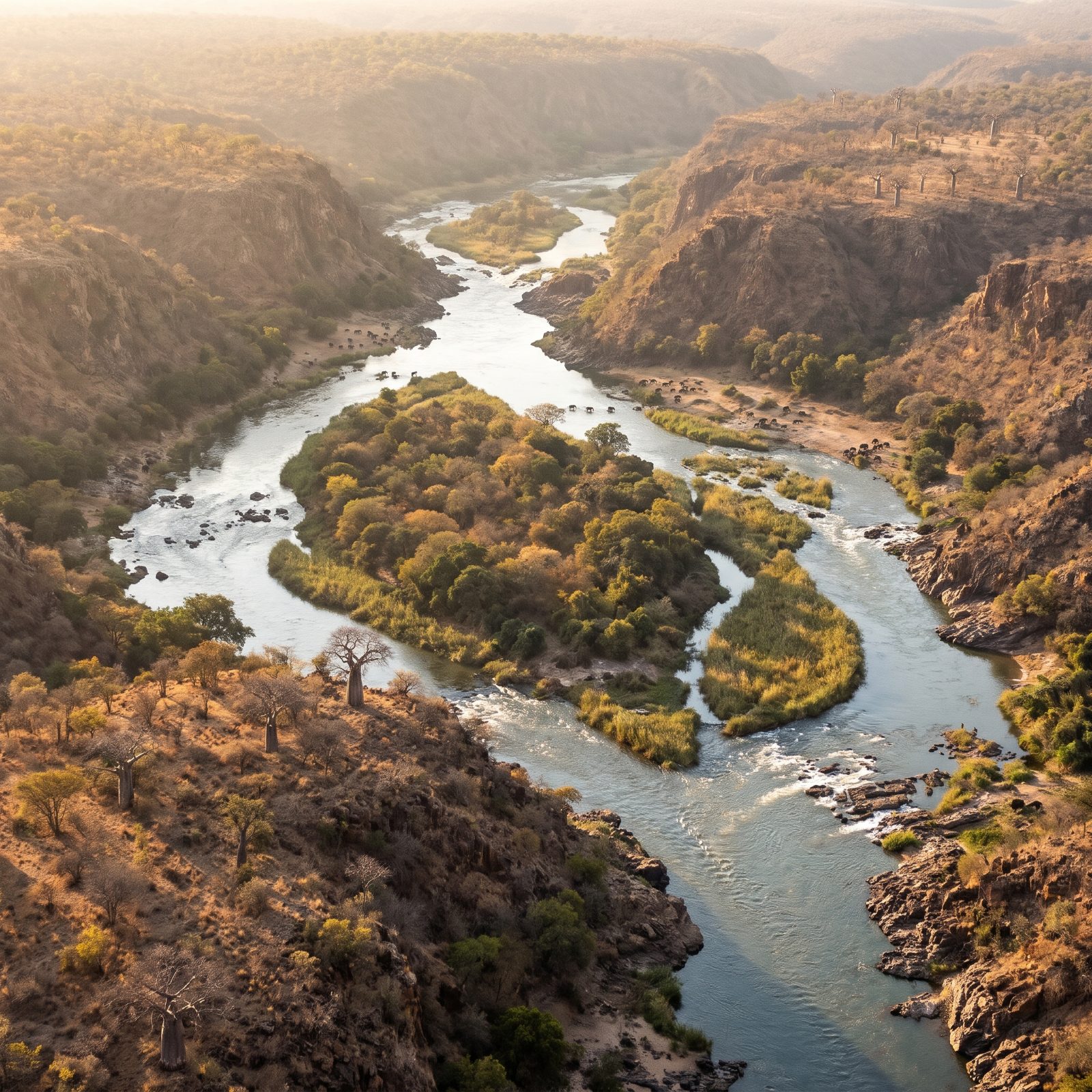
When Kariba Dam closed in 1958, the rising water trapped thousands of animals on shrinking islands. A rescue effort called Operation Noah ferried them to dry land, one terrified antelope at a time.
Before that, the Zambezi ran through a gorge flanked by mopane woodland and baobabs, home to the Tonga people who had lived on the river for generations. Kariba flooded their valley and created one of the largest artificial lakes in the world. The Tonga were resettled onto poorer ground. They had believed a river god named Nyaminyami lived in the gorge and would never let the dam stand. The dam stood. The valley did not.
41. The Columbia Before Grand Coulee Dam Blocked the Salmon
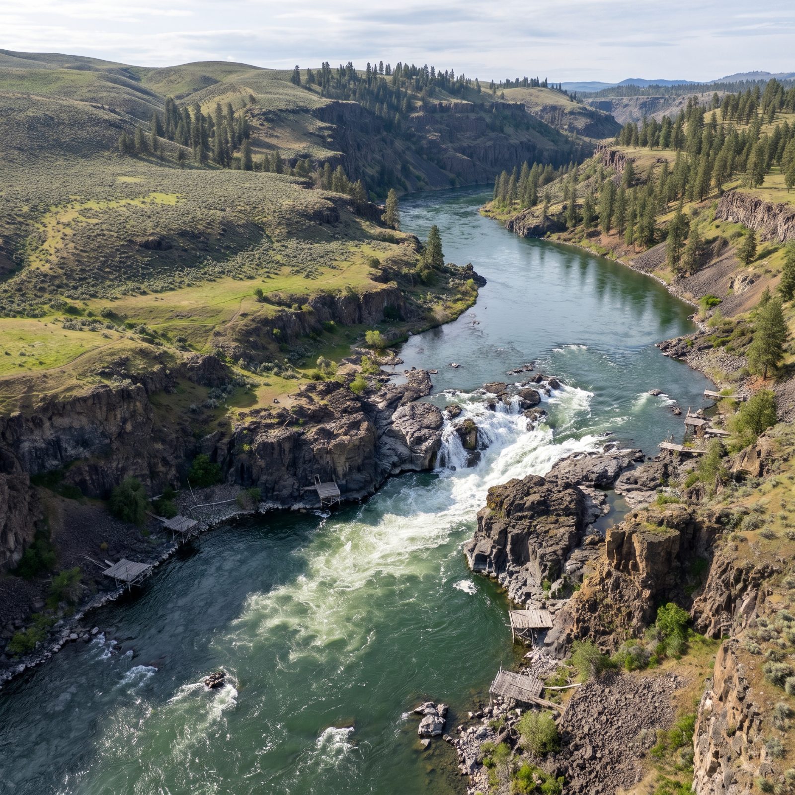
Kettle Falls was one of the great salmon fisheries on the continent. Native peoples gathered there for thousands of years, dipping nets into the churn as millions of fish fought upstream to spawn.
Grand Coulee Dam, completed in 1942, was built with no fish ladders. None. It simply walled the river off, and everything that spawned above it — more than a thousand miles of habitat — got cut off in a single stroke of construction. The falls drowned under the reservoir. The upstream salmon runs ended, and they have never come back.
40. The Danube Before the Iron Gates Dams Swallowed an Island
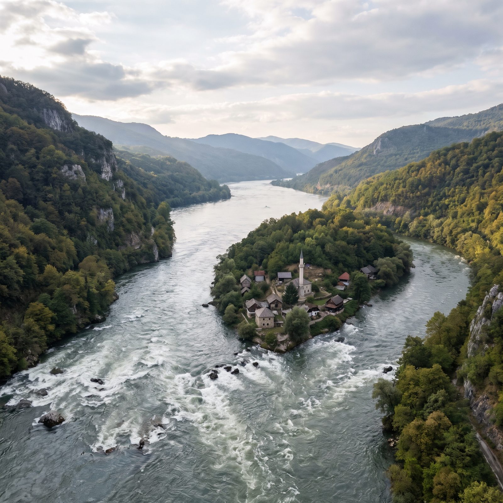
The Iron Gates was the Danube at its most dangerous — a gorge where the river crashed through rapids so fierce that boats once needed to be hauled through by chains and horses. The first dam went up in the 1970s, a joint Yugoslav-Romanian project.
The rising water drowned the rapids and an inhabited island called Ada Kaleh, a tiny Ottoman-era community with a mosque and a bazaar that had sat in the river for centuries. There were plans to move it stone by stone. The plans fell apart. Ada Kaleh is now at the bottom of the reservoir, remembered mostly in old photographs and the stories of the people who left. The scene pictured here imagines that lost world: an aerial view of the river surging through white-water rapids in a steep wooded gorge, past a small island village of stone and timber houses gathered around a slender minaret.
39. The Volga Before Its Cascade of Dams Turned It Into Reservoirs
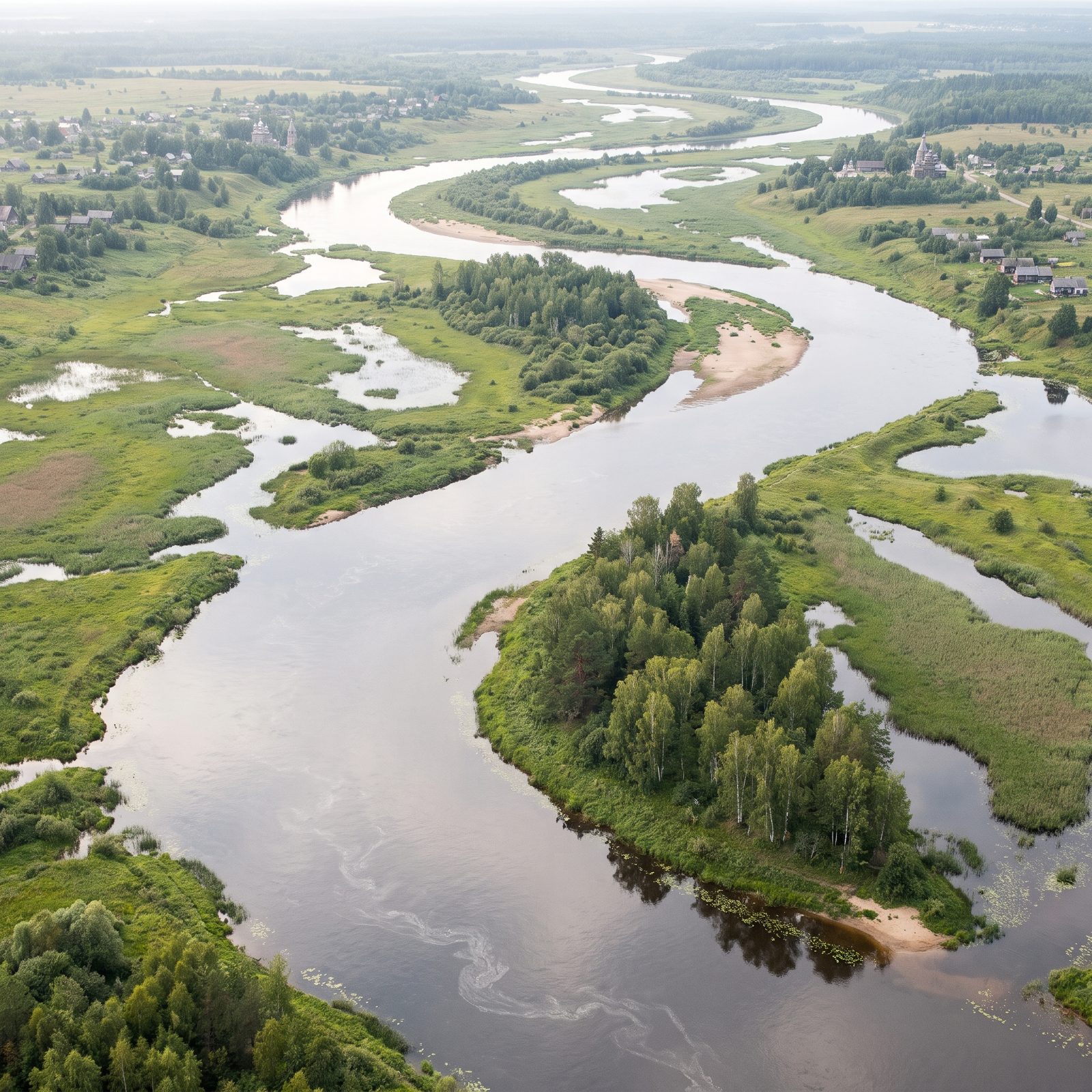
The Volga was never a wild mountain torrent. It was a slow, enormous lowland river, the heart of Russia, winding past wooden villages and flooding broad meadows each spring.
Through the mid-twentieth century it was carved into a staircase of reservoirs, one dam after another, until much of the free-flowing river had become a chain of artificial lakes. Towns were deliberately flooded. The best known is Mologa, a whole town submerged in the 1940s, its ruins occasionally reappearing when the water drops low enough. Old residents still gather to look at where their streets used to be.
38. The Mekong Before Its Mainstream Dams Interrupted the Great Pulse
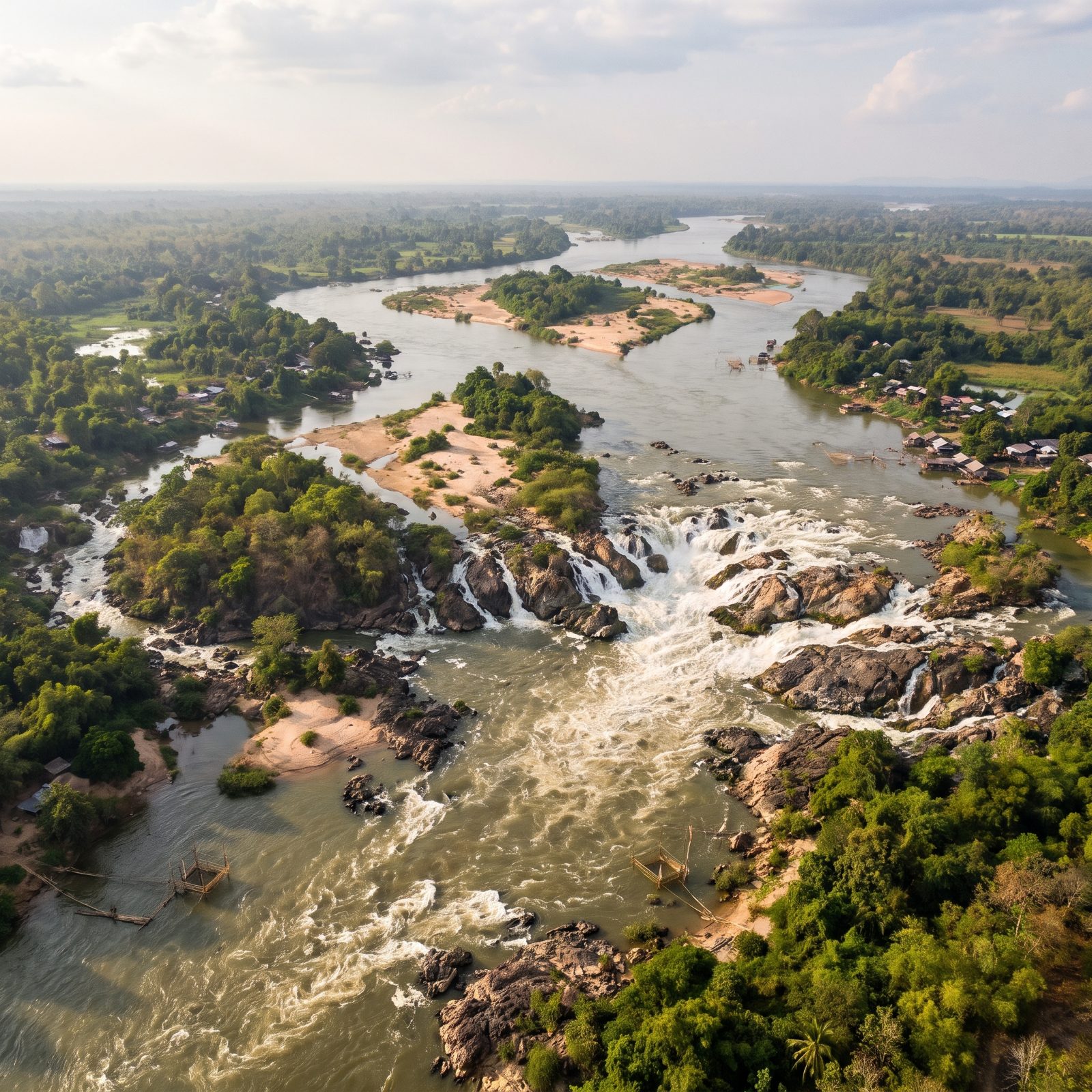
The Mekong has a heartbeat. Each wet season it swells so hard it forces a tributary in Cambodia to reverse direction and flow backward, filling a giant lake that feeds one of the richest inland fisheries on Earth. That pulse is why tens of millions of people eat.
The river also holds the Khone Falls, a maze of channels and cascades so wide it blocked boats from traveling the whole river. Fish migrated through it in staggering numbers.
Dam the pulse and you do not just stop water. You stop the fish, the silt, and the flood that farmers downstream have planted around for generations.
This one is still being written. Many of the proposed dams are recent or under construction, and scientists are actively debating how much of that pulse will survive.
37. The Euphrates Before Atatürk Dam Flooded Ancient Ground
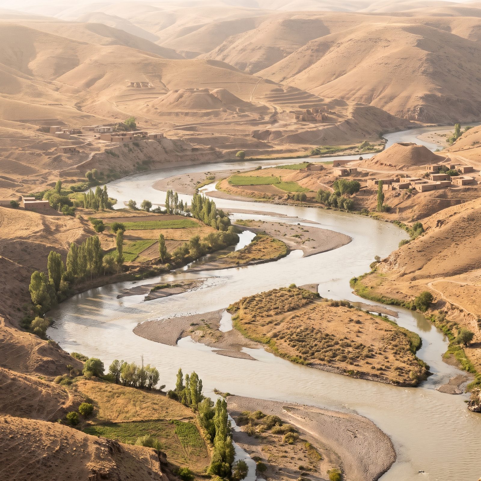
This is one of the two rivers that cradled the first cities. The land along the Euphrates is layered with human history going back thousands of years, mounds and settlements stacked on older settlements.
The Atatürk Dam, completed in 1992, is one of the largest in the world. Its reservoir submerged villages and archaeological sites, some only partly excavated before the water came. Archaeologists worked against the clock. A lot got documented. A lot did not. The river that watered the dawn of civilization now runs where engineers decide, and the flow reaching Syria and Iraq downstream has become one of the tensest water disputes anywhere.
36. The Indus Before Tarbela Dam Rose From the Glacier Melt
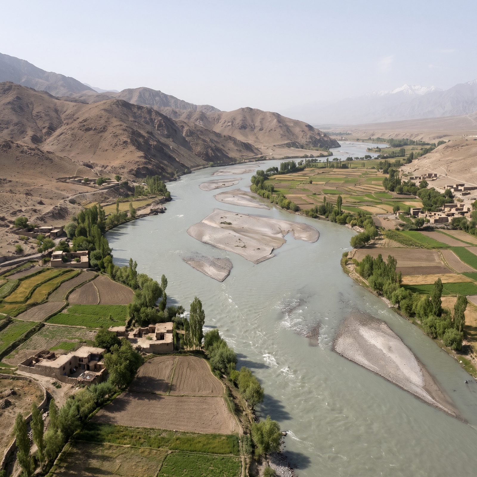
The Indus is born from Himalayan glacier melt and runs grey-green with rock flour, the ground-up dust of mountains. Before Tarbela Dam closed in the 1970s, it surged out of the foothills and spread across its valley, carrying the silt that built Pakistan’s farmland for millennia.
Tarbela is one of the largest earth-filled dams on Earth. It gave the country water storage and power. It also began filling with sediment the day it opened — the slow problem every big dam on a silty river eventually faces. The reservoir is always, quietly, shrinking from the bottom up. The free river moved that silt downstream; the dam keeps it.
35. The Paraná River Before Itaipu Dam Flooded Guaíra Falls
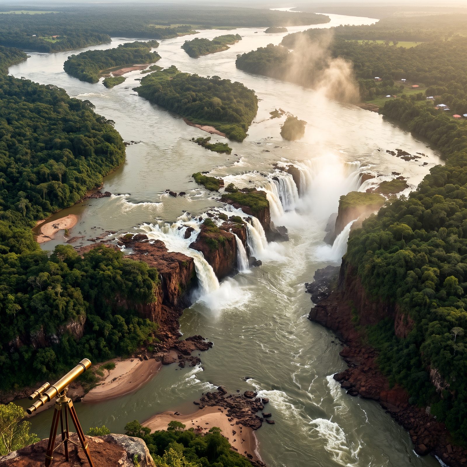
Before 1982 the Paraná dropped through Guaíra Falls, a run of cataracts so loud you felt them in your chest from a mile off. Locals called it Sete Quedas, the seven falls, though there were closer to eighteen.
The reservoir behind Itaipu drowned all of it, and then engineers dynamited the submerged rock afterward to clear navigation hazards. So the falls are gone twice over. Nothing left to restore.
34. The Congo River Before the Inga Dams Tamed Its Rapids
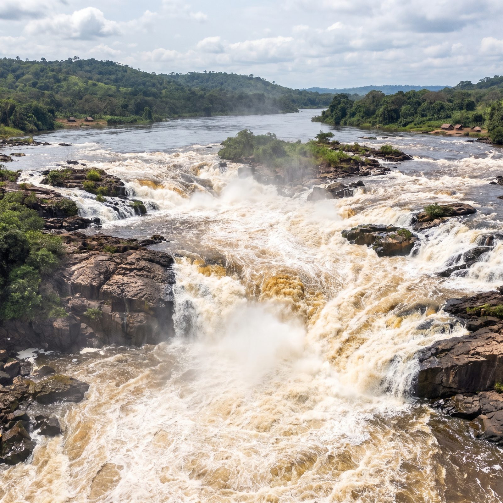
The Inga Rapids carry more water than any other rapids on Earth. Tens of thousands of cubic meters a second roar down a 60-mile drop of broken granite, a horizontal Niagara that never stops.
The Inga I and II dams, built in the 1970s and 80s, siphoned off part of that flow, and the long-planned Grand Inga would be the largest hydro project ever attempted. For now the heart of the rapids still runs wild, which makes this picture less a resurrection than a warning shot.
33. The Yellow River Before Sanmenxia Dam Silted Itself Shut
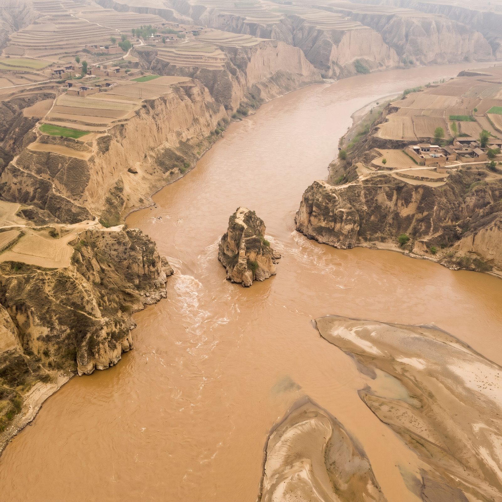
Sanmenxia is the cautionary tale every engineering student should study. The name means Three Gate Gorge, after the channels that once ran around rock pillars like the lone one splitting the brown current here. Finished in 1960, the dam is famous mostly for backfiring.
The Yellow River carries more silt than almost any river alive. Within a few years the reservoir filled with sediment, backing mud up toward the city of Xi’an and forcing expensive retrofits that nobody had budgeted for. The free-flowing version pictured here carried its load downstream the way it had for millennia, building the North China Plain one flood at a time.
32. The Missouri River Before Fort Peck and Garrison Dams Straightened the Plains
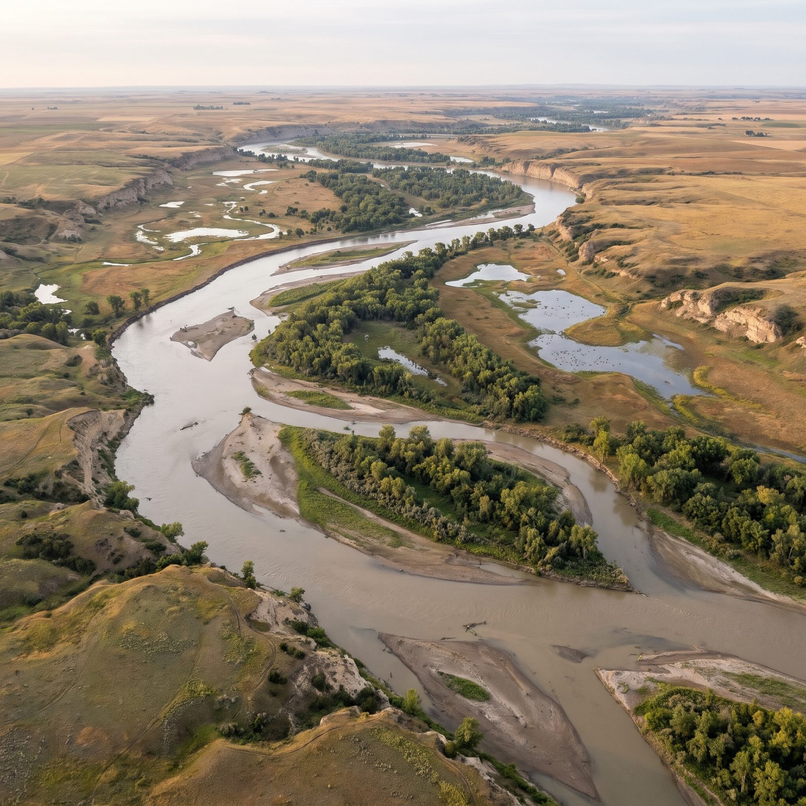
Lewis and Clark described a river that moved. The Missouri braided across its floodplain, abandoned old channels, piled up sandbars and tore them down again every spring.
Fort Peck (1940) and Garrison (1953) pinned it in place, and six big dams now hold the Missouri like a series of bathtubs. The braided, cottonwood-studded river that once raised a whole ecosystem of least terns, piping plovers and pallid sturgeon, which the slackwater versions nearly erased, now survives mostly in a few free-flowing reaches, like the one seen here from above, where the channel still splits around sandbars and cottonwood islands beneath eroded bluffs and golden prairie.
31. The Tennessee River Before the TVA Dam System Wired the South
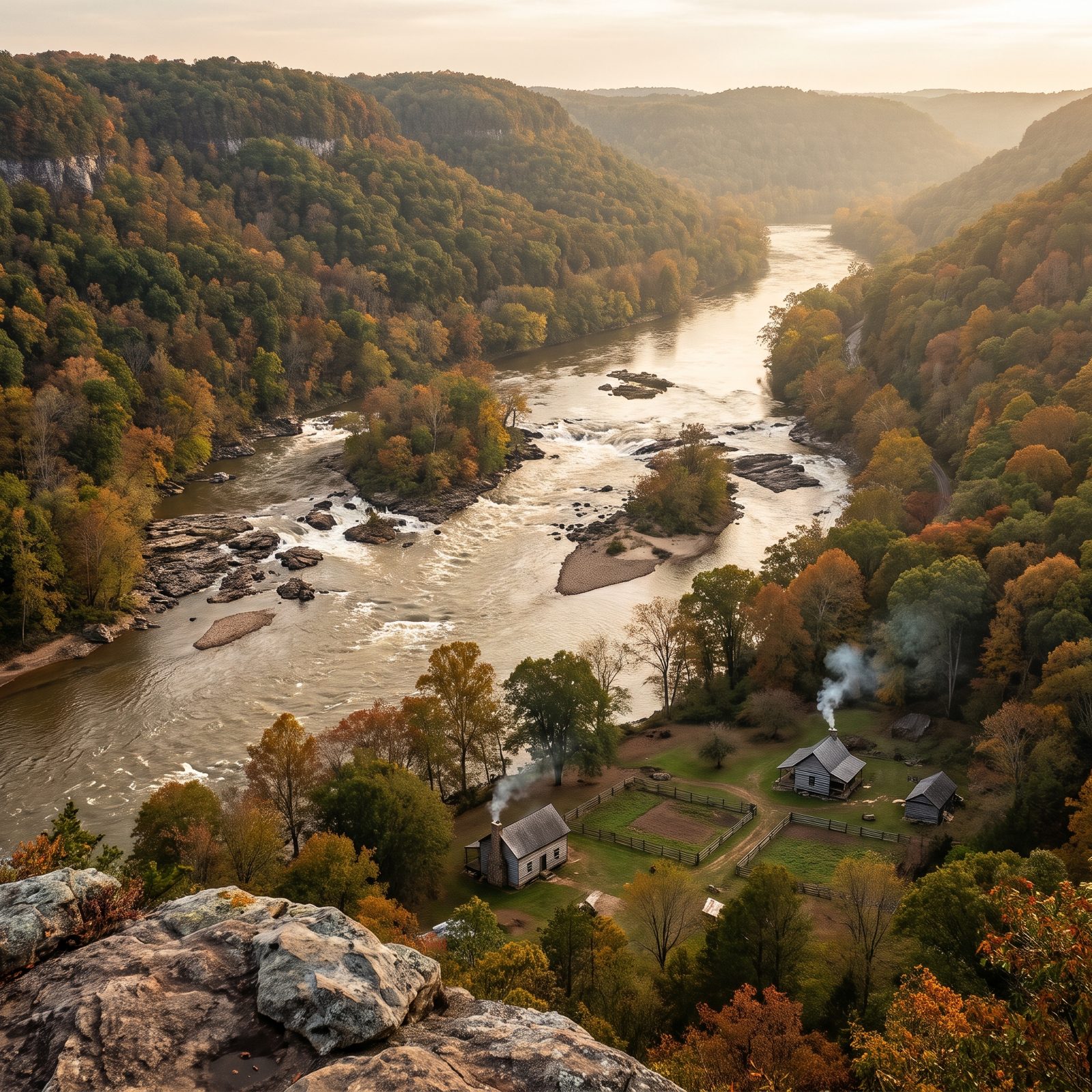
You know the postcard version of the TVA: smooth lakes, boat ramps, cheap electricity that pulled the rural South into the twentieth century. Worth remembering what it covered.
The Tennessee ran shallow and rowdy, broken by shoals like Muscle Shoals, where the water dropped 140 feet across a few miles of rock. Mussels colonized those shoals in staggering numbers — the basin held the richest freshwater mussel diversity on the planet, a fact that almost nobody outside a malacology seminar ever hears.
Built fast between the 1930s and 50s, the dams turned the whole river into a staircase of reservoirs. Dozens of mussel species went extinct. The reconstruction above shows the loud, shallow river that fed them.
30. The Rio Grande Before Elephant Butte Dam Dried the Desert Stretch
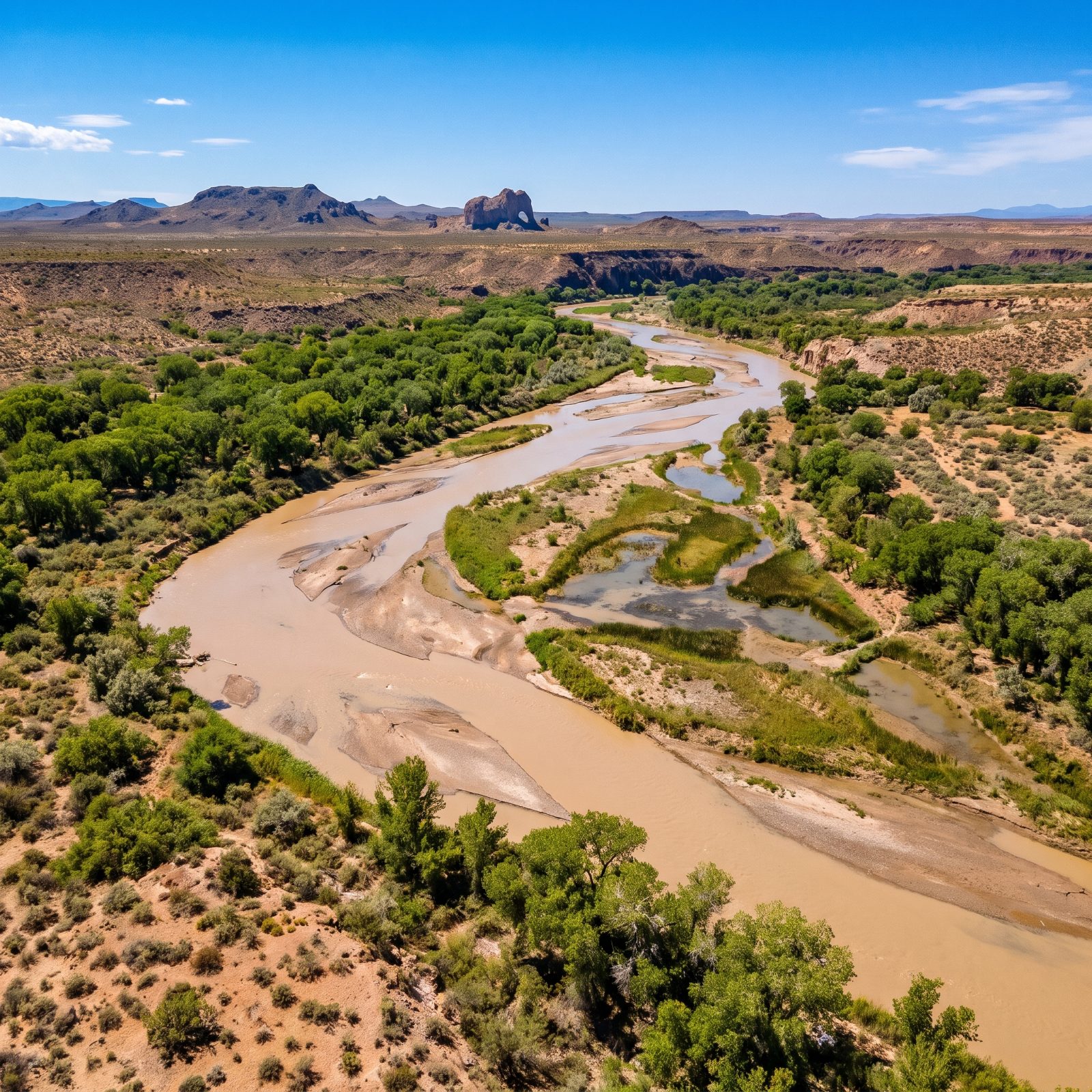
Elephant Butte Dam (1916) was one of the earliest big Reclamation projects, built to hand irrigation water to farmers downstream. It did its job. It also rewrote the river.
Before the dam the Rio Grande through here flooded, shifted and fed a continuous cottonwood bosque. Today much of the lower river runs dry for part of the year, its water parceled out by compact and treaty among Colorado, New Mexico, Texas and Mexico.
29. The Tigris River Before Ilısu Dam Swallowed Hasankeyf
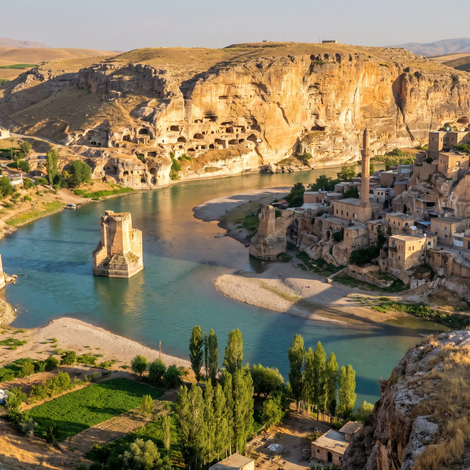
Hasankeyf was inhabited for something like 12,000 years. Caves cut into the limestone, a medieval bridge, Roman and Byzantine and Ayyubid layers stacked along the Tigris — one of the oldest continuously settled places on Earth.
The Ilısu reservoir began flooding it in 2020. A handful of monuments were cut from the rock and dragged to higher ground on enormous trailers. The rest is underwater.
28. The Ganges River Before the Farakka Barrage Split Its Flow
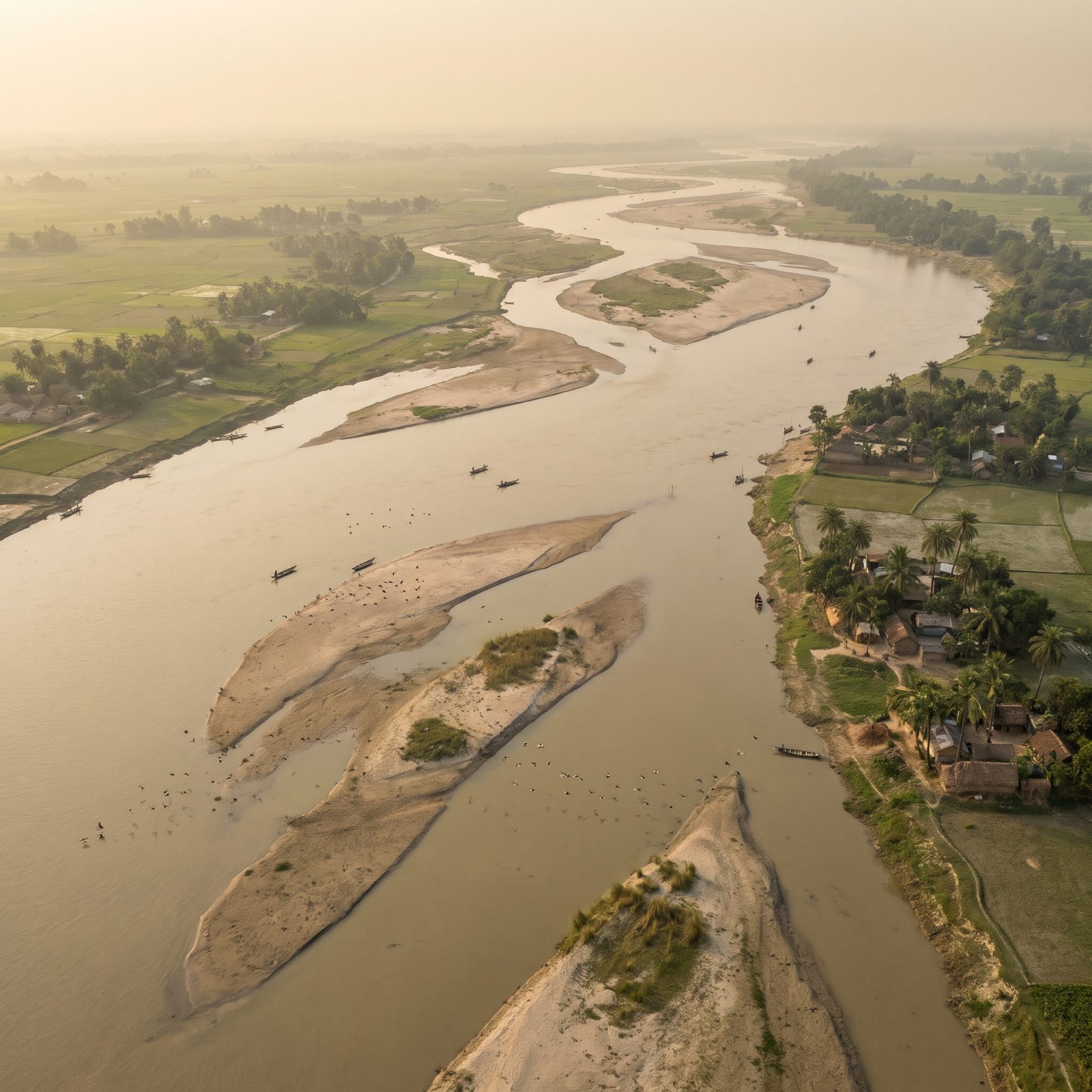
A barrage is not quite a dam. The Farakka Barrage, finished in 1975, is a wall of gates that diverts part of the Ganges into a feeder canal to flush silt out of Kolkata’s harbor.
It solved one problem and started several. The diversion cut flow into Bangladesh downstream, drying the dry season and salting the delta. The free-flowing Ganges pictured here fed the Sundarbans and let the hilsa fish run upstream to spawn. The gates stopped the fish cold.
27. The Narmada River Before Sardar Sarovar Dam Raised the Waters
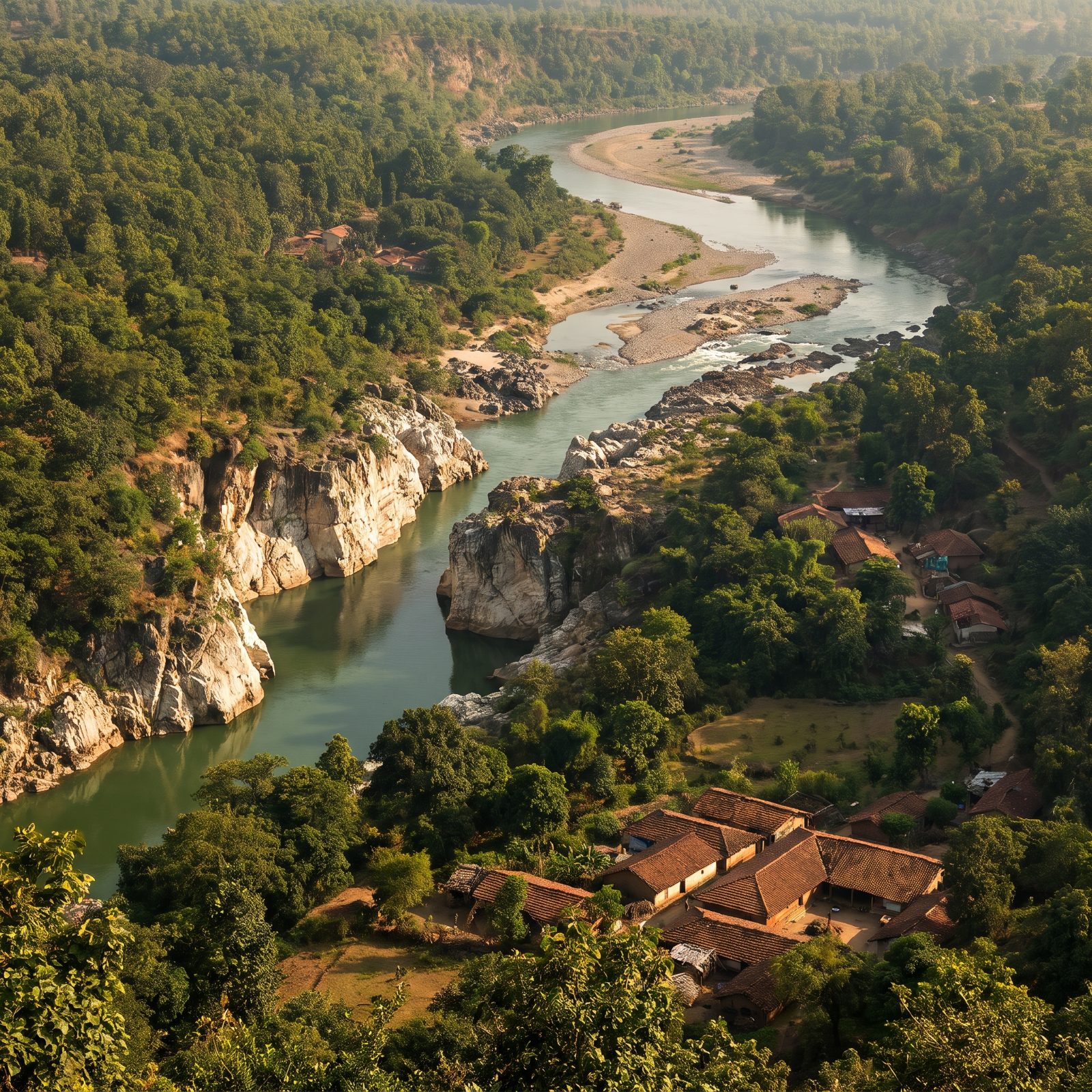
The Narmada is sacred. Pilgrims walk its entire length, down one bank and up the other, a journey that takes years. The river you see here is the one they walked.
Sardar Sarovar, raised to its full height in 2017, is the largest of a planned chain of dams on the Narmada. Its reservoir displaced hundreds of thousands of people, many of them Adivasi, and it set off one of the longest-running protest movements in India. The marble gorges and forested banks pictured are what the slow-rising water took, village by village.
26. The Sutlej River Before Bhakra Dam Walled the Shivalik Gorge
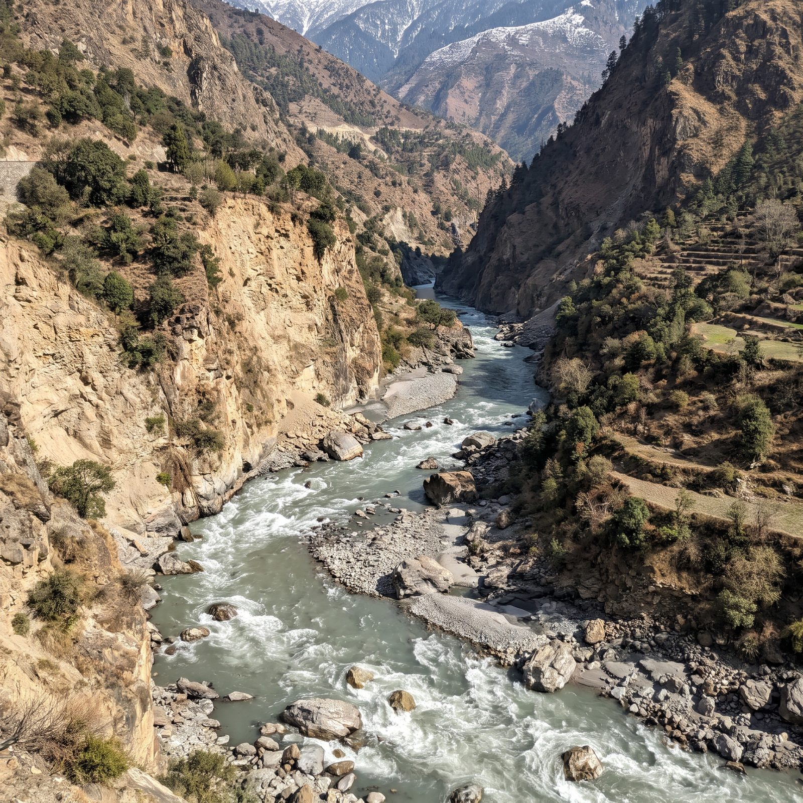
Bhakra Dam went up in the 1950s as a symbol of newly independent India. Nehru called the big dams the temples of modern India and meant it. The Sutlej was the raw material.
Before the wall, the river tore through the Shivalik gorge grey with glacial melt, fed by Himalayan snow and the monsoon. That rushing mountain river is what the reconstruction above shows. What replaced it, Gobind Sagar reservoir, waters the fields of Punjab and Haryana and arguably fed the Green Revolution. A loud river traded for a quiet lake and a lot of wheat. History rarely offers a cleaner bargain, or a sadder one.
25. The Murray River Before Hume Dam Tamed Its Floods
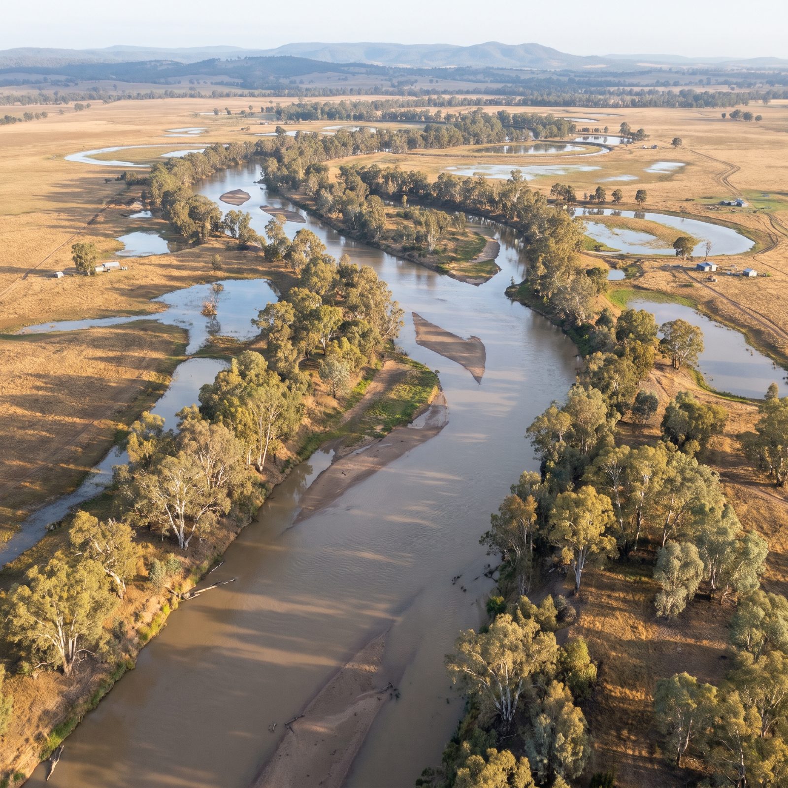
Before 1936, the Murray ran on its own schedule. It flooded in spring, shrank to a chain of muddy pools by late summer, and the river red gums timed their whole lives around that boom and bust.
Hume Dam flipped the calendar, so now the river runs fullest in summer for irrigation and lowest in winter — the exact reverse of what the floodplain evolved with. The reconstruction shows the old braided channel and its billabongs, those crescent wetlands left behind when the river shifted course.
24. The Snowy River Before Jindabyne Dam Starved It
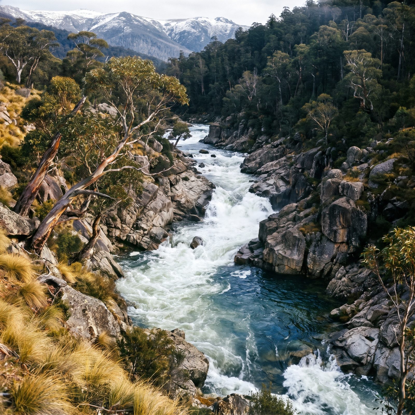
The Snowy once carried the whole Alps to the sea. Snowmelt, hard and clear, muscling through granite gorges with enough force to flip a car-sized boulder.
Then the Snowy Mountains Scheme diverted it inland for power and irrigation, and by the 1990s barely a whisper of its original flow reached below Jindabyne. The river you see here, surging and loud, became a memory of itself. Environmental flows were later restored — but only a fraction of what once ran.
23. The Waikato River Before Eight Dams Stepped It Down
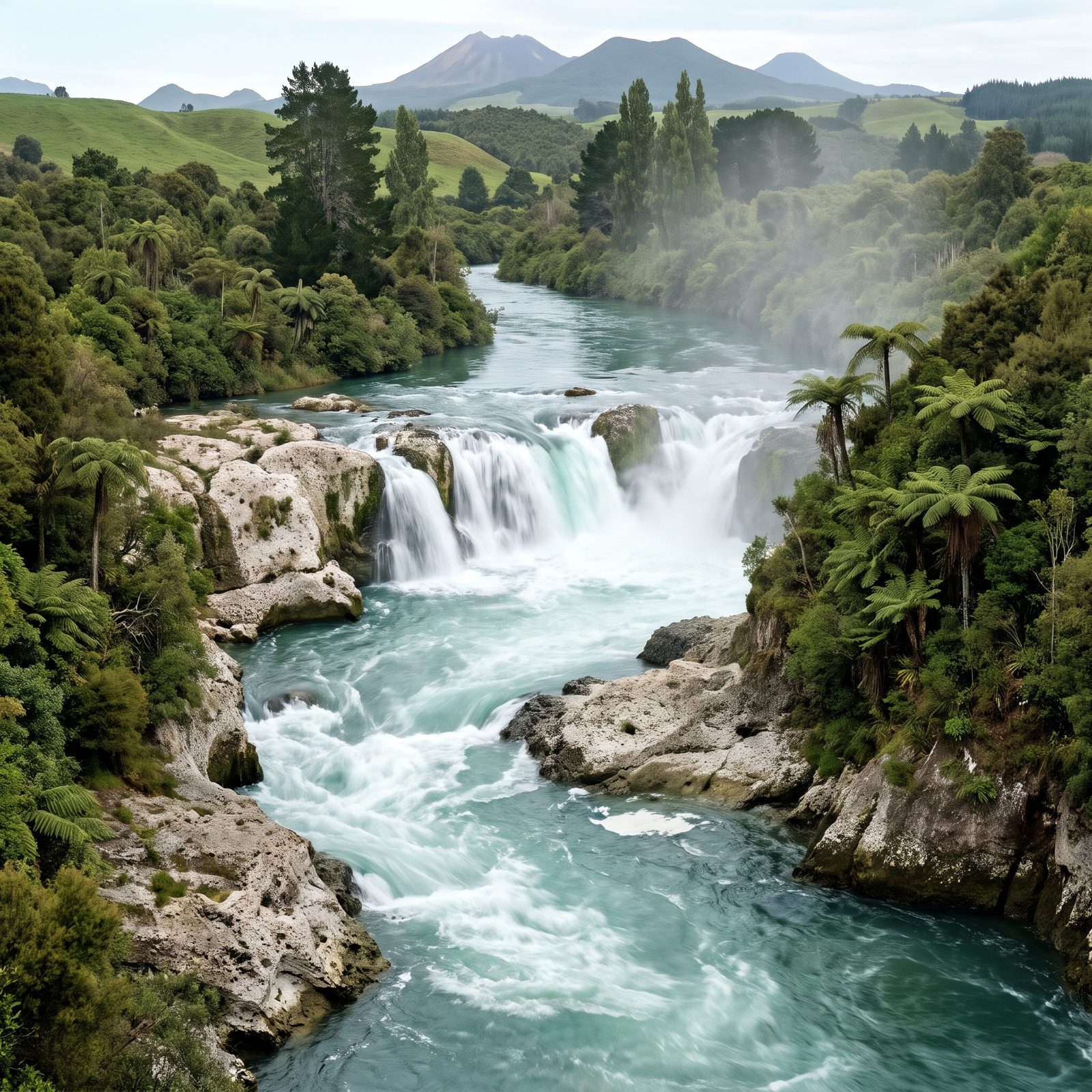
New Zealand’s longest river once ran as a continuous staircase of rapids and falls, its distinctive aquamarine color coming from fine volcanic rock held in suspension.
Eight dams turned the Waikato into a chain of calm lakes stacked one above the next. The reconstruction brings back the free-flowing cascades, including the falls that once thundered where still water now sits.
22. The Clutha River Before Clyde Dam Drowned Cromwell Gorge
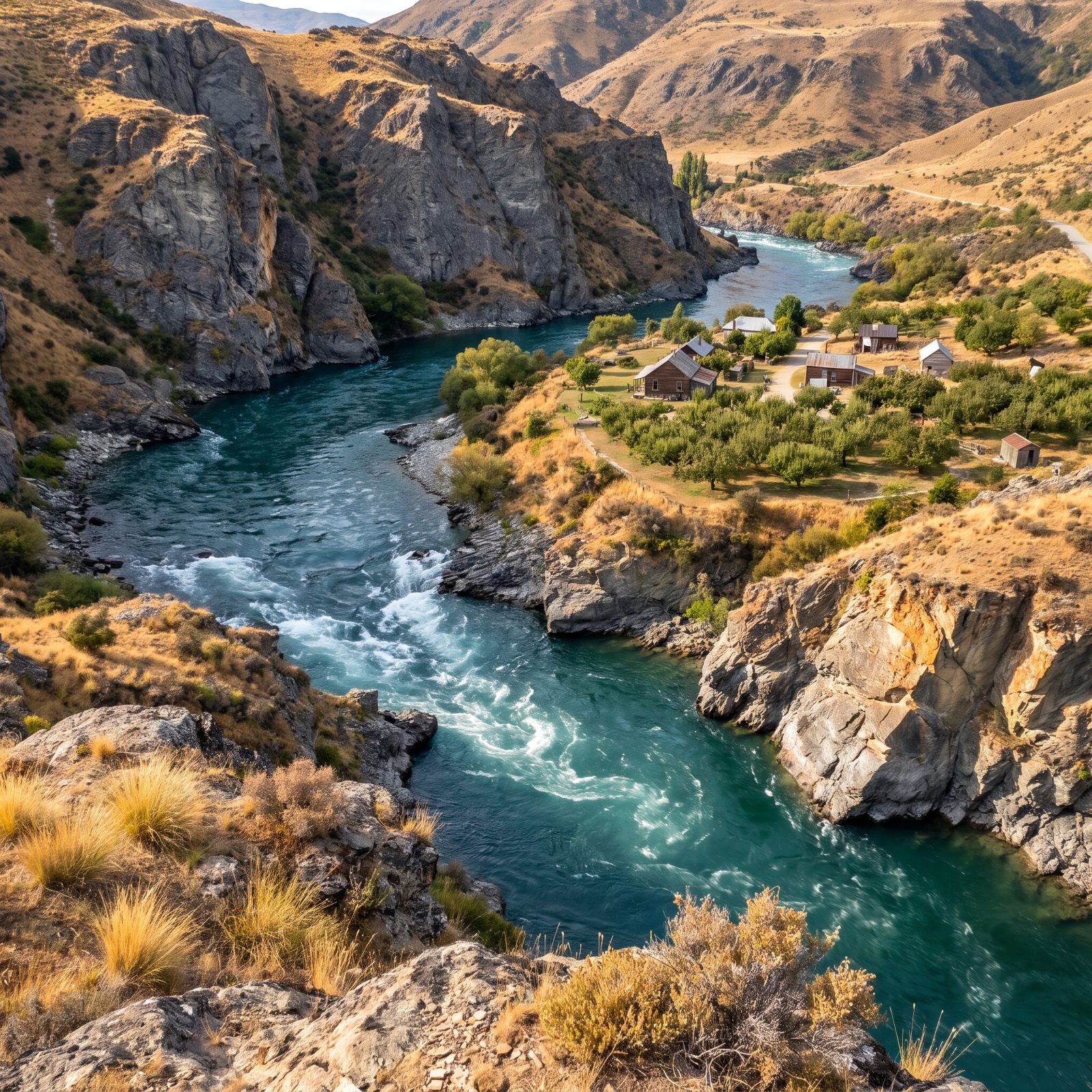
New Zealand’s highest-volume river moved more water than any other on these islands — a cold teal flood born in the Southern Alps.
Clyde Dam sealed off Cromwell Gorge in the early 1990s, and the rising reservoir swallowed the old heart of the fruit-growing town of Cromwell, orchards and all. The reconstruction restores the swift river in its schist canyon, with the original town standing at the water’s edge before Lake Dunstan covered it.
They moved what they could. The river bend where the apricots grew sits well underwater now.
21. The Rhône Before Génissiat Dam Ran Wild and Green
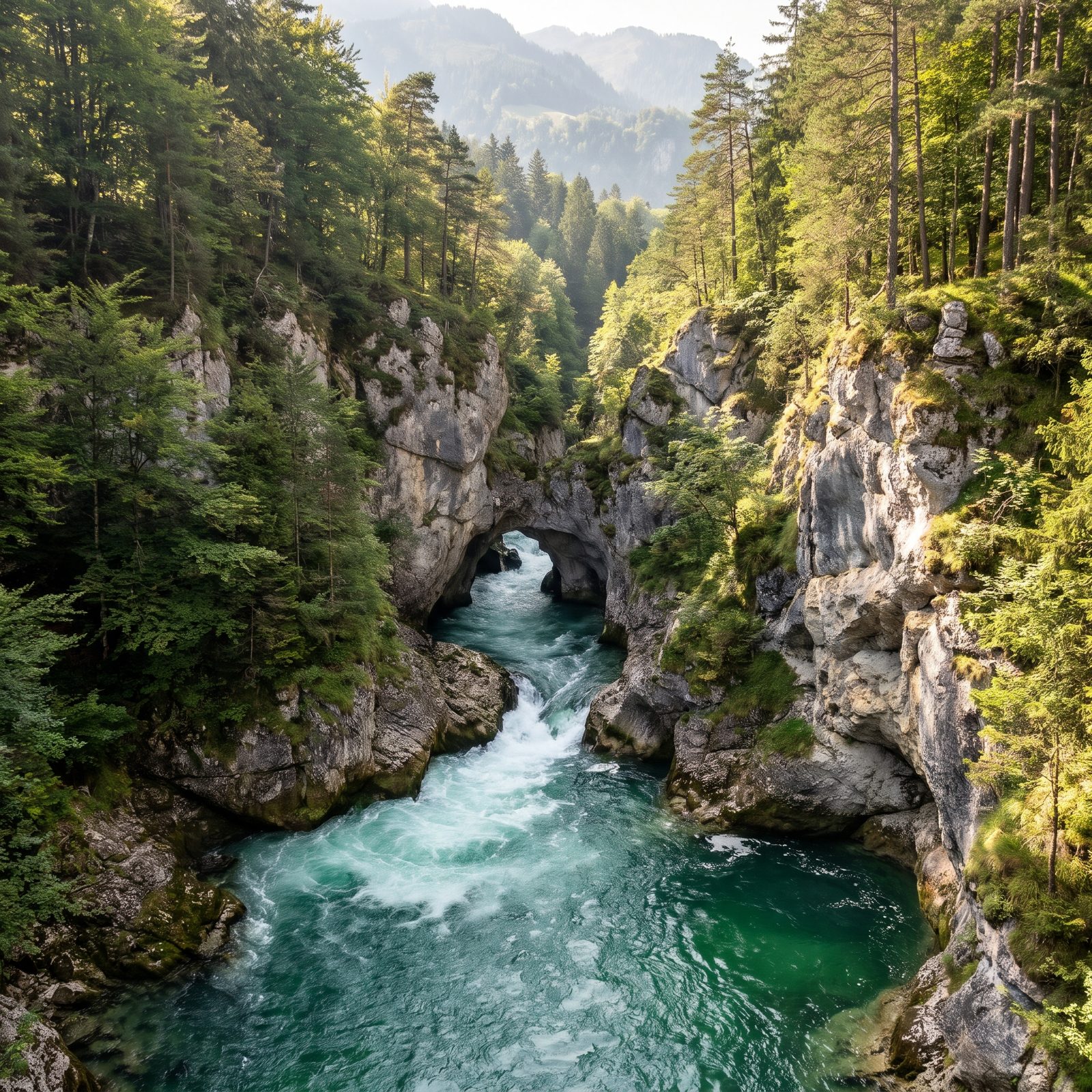
The upper Rhône once performed a disappearing act. At the Perte du Rhône, the whole glacial river funneled into a limestone slot so narrow you could nearly step across it, then vanished underground when the water ran low.
Génissiat Dam, finished in 1948, flooded that gorge for good. Here you see the emerald alpine water squeezing through rock — one of Europe’s most dramatic river features before engineering erased it.
20. The Rhine Before Its Barrage System Boxed It In
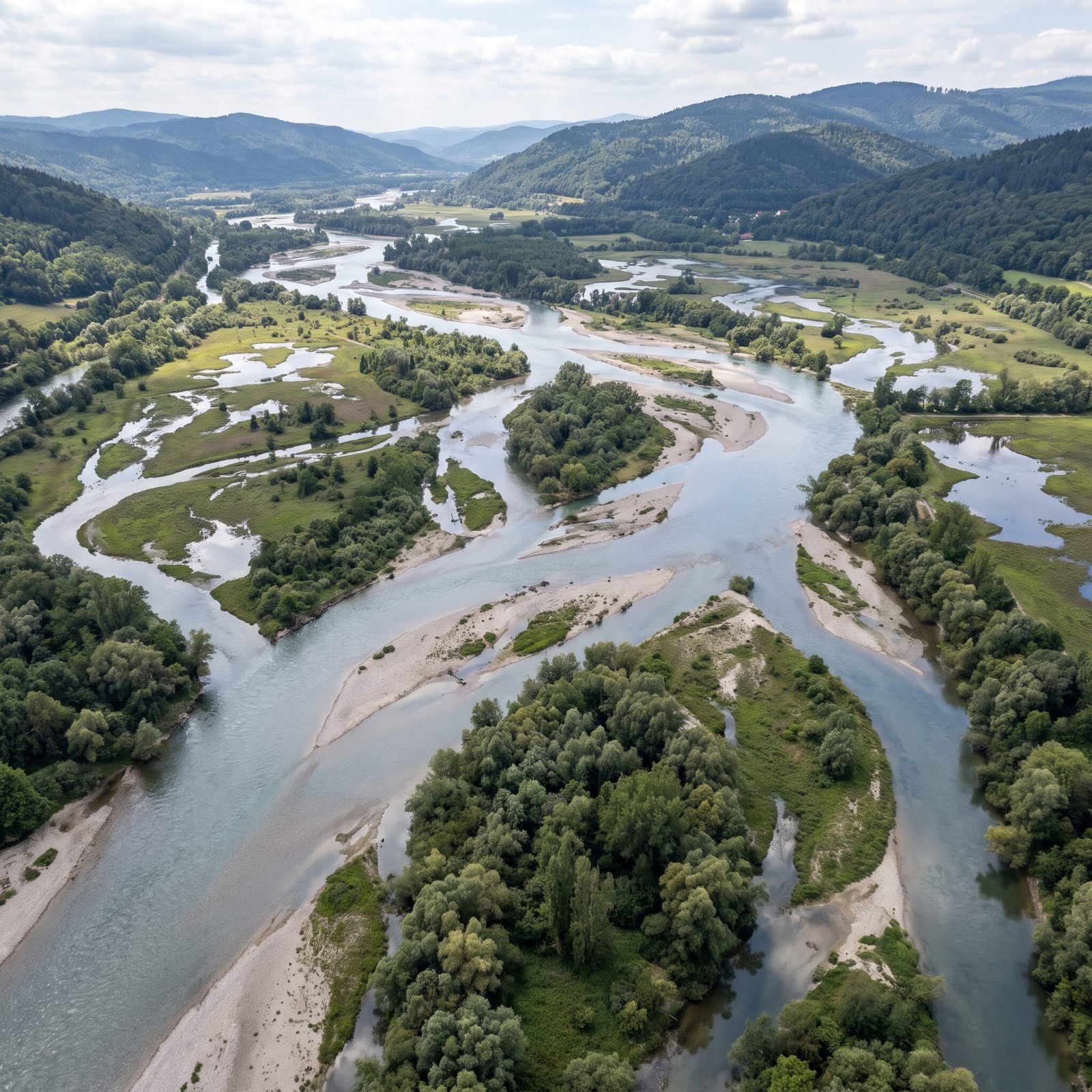
The Upper Rhine used to be a shifting maze. Before the 19th century it braided across its floodplain in dozens of channels, carving new islands and abandoning old ones every flood season.
Then engineers straightened and shortened it, and the barrages later locked the flow into a navigable canal. What you see here is the wild braided river, miles wide in places — a malaria-ridden wilderness of islands and backwaters that once separated France from Germany.
19. The Dnieper Before Its Hydroelectric Dam Submerged the Rapids
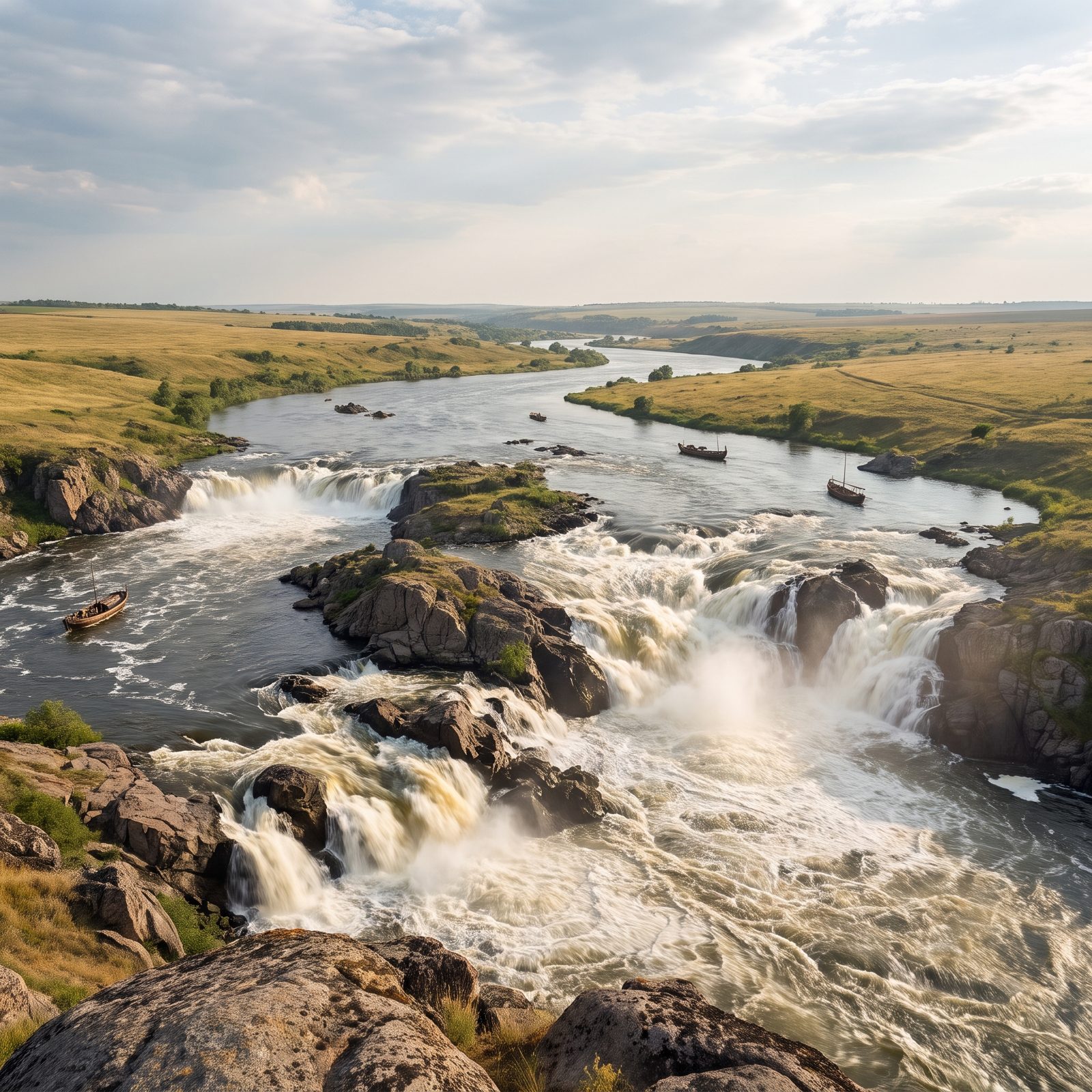
For a thousand years the Dnieper Rapids decided who could trade down this river. Nine granite cataracts that boats had to be hauled around by hand, feared by Vikings and Cossacks alike.
The Dnieper Hydroelectric Dam, completed in 1932, drowned all nine under a single reservoir. Here the cataracts are back in full fury — a stretch of water that shaped the history of an entire region before it went silent underwater.
18. The Yenisei Before Krasnoyarsk Dam Froze Into a Reservoir
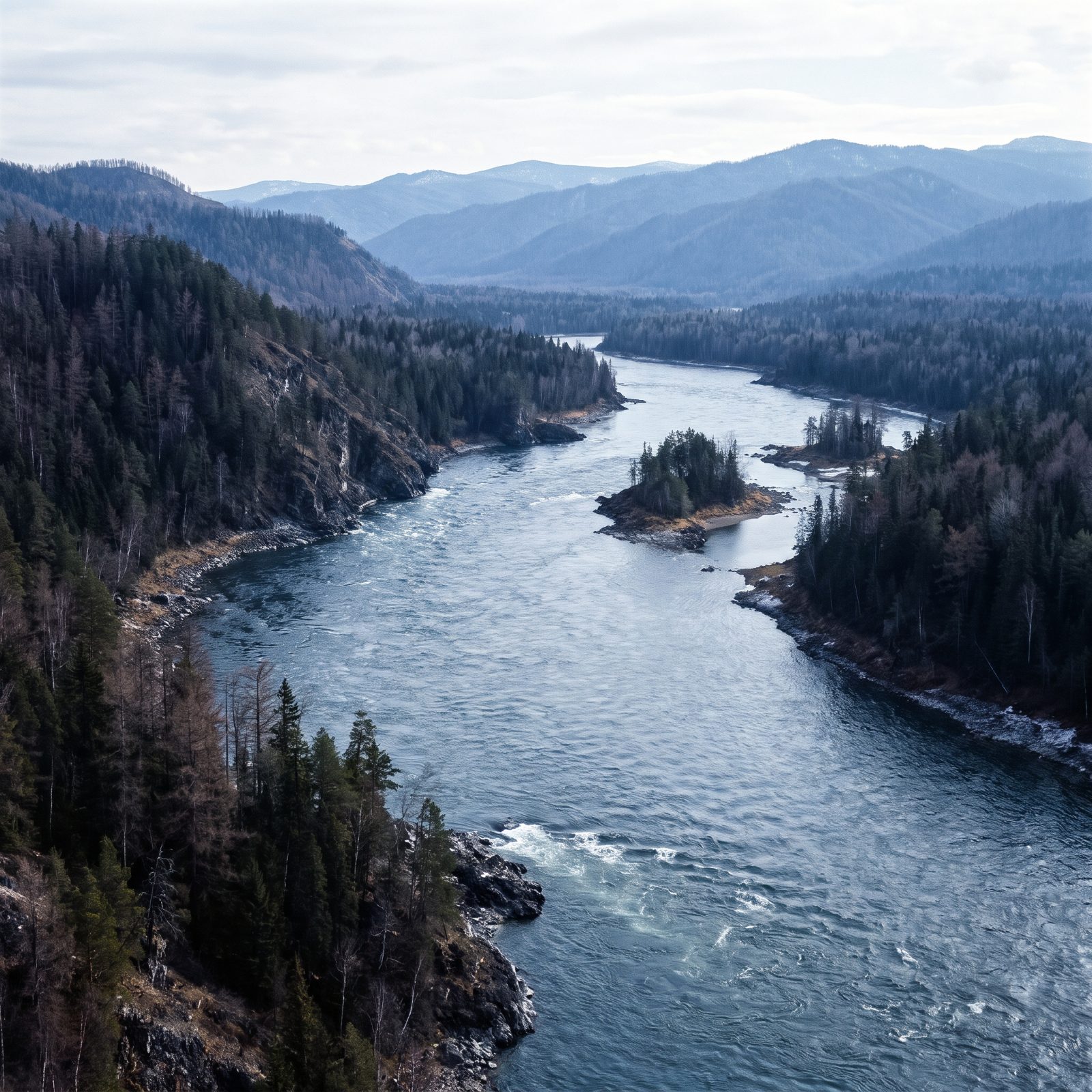
The Yenisei is one of the planet’s great rivers, pouring Siberian snowmelt north toward the Arctic through endless taiga.
Krasnoyarsk Dam, finished in 1972, created a reservoir hundreds of miles long and did something genuinely strange. Water released from its depths stays above freezing, so the river below never freezes in winter, steaming in the Siberian air. The scene here shows the taiga-lined river before that reach of water flooded the valley.
17. The Angara Before Bratsk Dam Flooded Its Valley
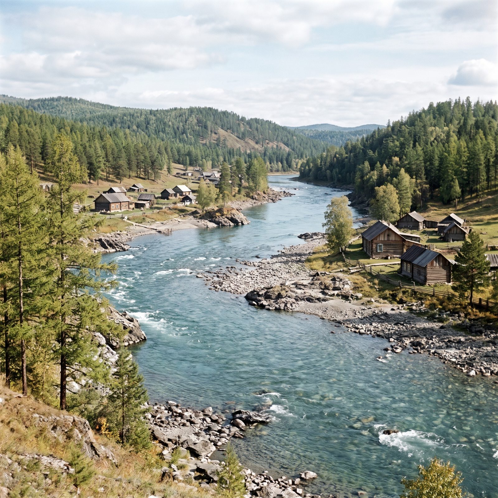
The Angara is the only river that flows out of Lake Baikal, and it inherits that lake’s famous clarity — water so clean you could count stones on the bottom.
Bratsk Dam, among the largest reservoirs on Earth when it filled in the 1960s, submerged a long valley of old Siberian villages. Whole communities of log houses went under. Here the clear river runs over its stony bed again, with the timber settlements still standing on its banks.
16. The Sacramento River Before Shasta Dam Cut Off the Salmon
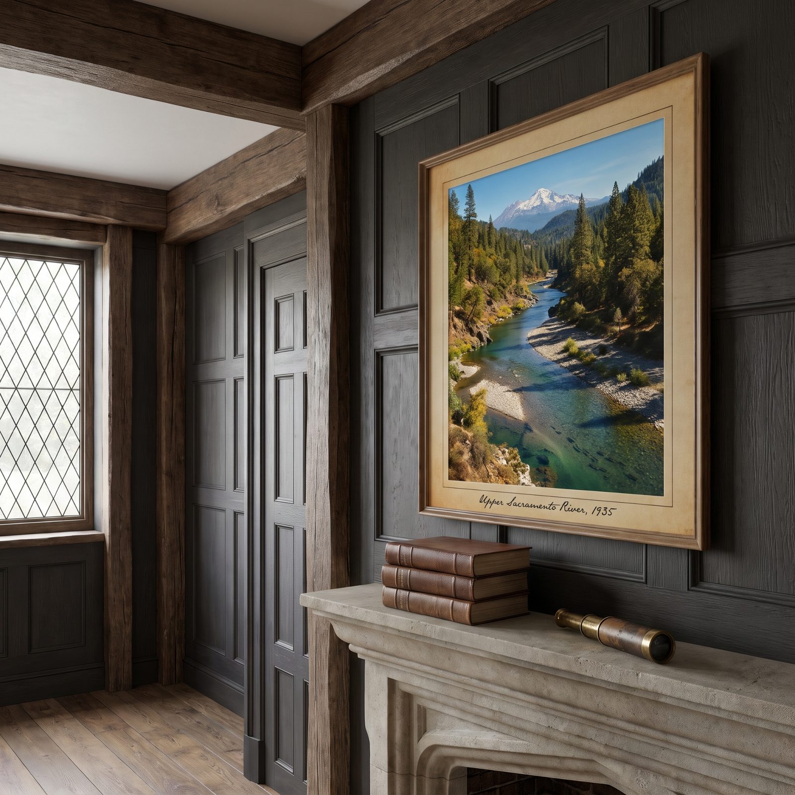
Before 1945, Chinook salmon ran all the way up the Sacramento and into the cold rivers below Mount Shasta to spawn, in one of the great salmon migrations of the West.
Shasta Dam walled that off completely. Salmon that had returned to those upper gravel beds for thousands of years suddenly hit a wall of concrete, hundreds of feet of it, and could go no further. The scene here shows the free-flowing river and its spawning gravels, salmon still working their way toward the mountain.
Crouched on a gravel bed of the McCloud River above Shasta Dam, a federal fisheries biologist says “When I see gravel like this and how clean it is, it really makes me excited and happy thinking about winter-run Chinook back in this watershed”
15. The San Joaquin River Before Friant Dam Dried Its Lower Reaches

Chinook salmon once ran up the San Joaquin all the way to the Sierra foothills. Then Friant Dam went up in the 1940s and shunted the water into irrigation canals instead, and for roughly sixty miles the river simply stopped — a dry bed where a major salmon river used to be.
Our reconstruction puts the braids and gravel bars back, the cottonwoods, the snowmelt. Strange thing, staring at a green floodplain while knowing the real version is mostly dust now.
14. The Snake River Before Four Lower Dams Slowed Its Rapids
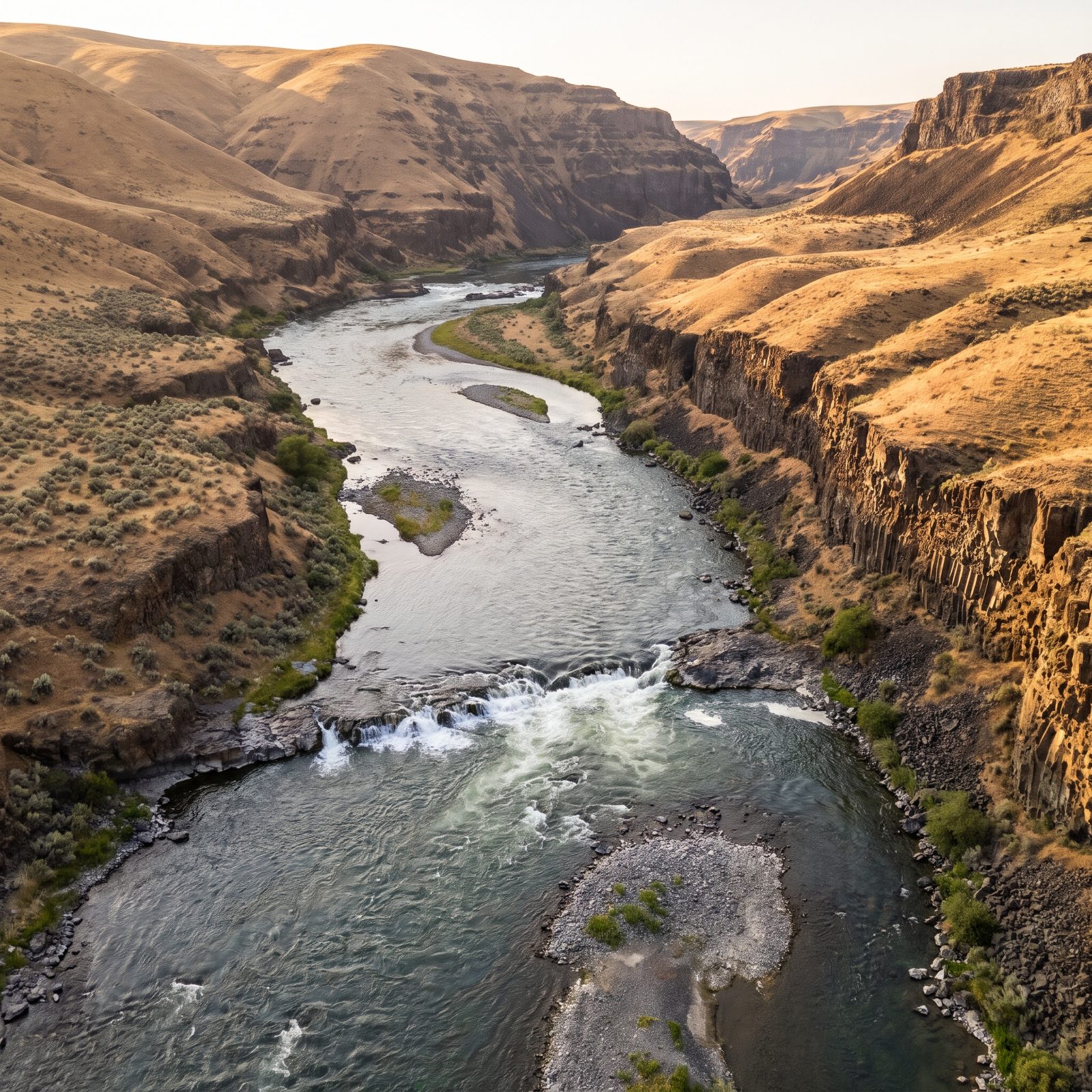
Before the four lower Snake River dams, this stretch ran fast and loud — rapids, not slackwater. The kind of river that carried millions of salmon and steelhead toward Idaho spawning gravel every year.
The dams flattened the current into a chain of reservoirs good for barge traffic. Our reconstruction brings back the broken water, the cobble islands, the basalt cliffs standing over actual whitewater. Scientists still argue over tearing these dams out to save the region’s salmon, and it’s one of the loudest fights of its kind in America.
13. The St. Lawrence River Before the Moses-Saunders Dam Drowned the Lost Villages
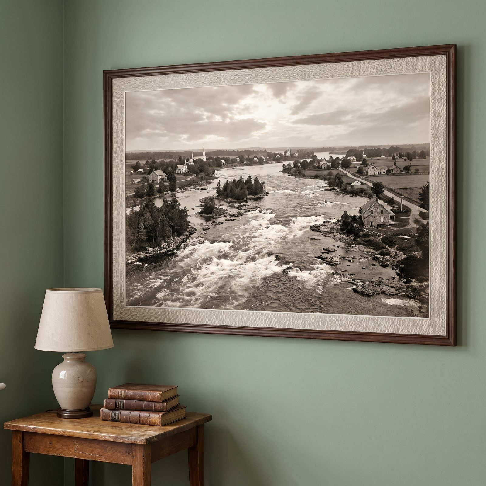
The Long Sault Rapids used to roar here, a legendary stretch of white water that gave the St. Lawrence its character and its danger.
When the Moses-Saunders dam was finished in 1958, the Seaway swallowed them — and ten communities with them. People called those drowned towns the Lost Villages. Whole places went under on a single July day as the water climbed behind the new barrier.
12. The Peace River Before W. A. C. Bennett Dam Carved a 250-Mile Reservoir
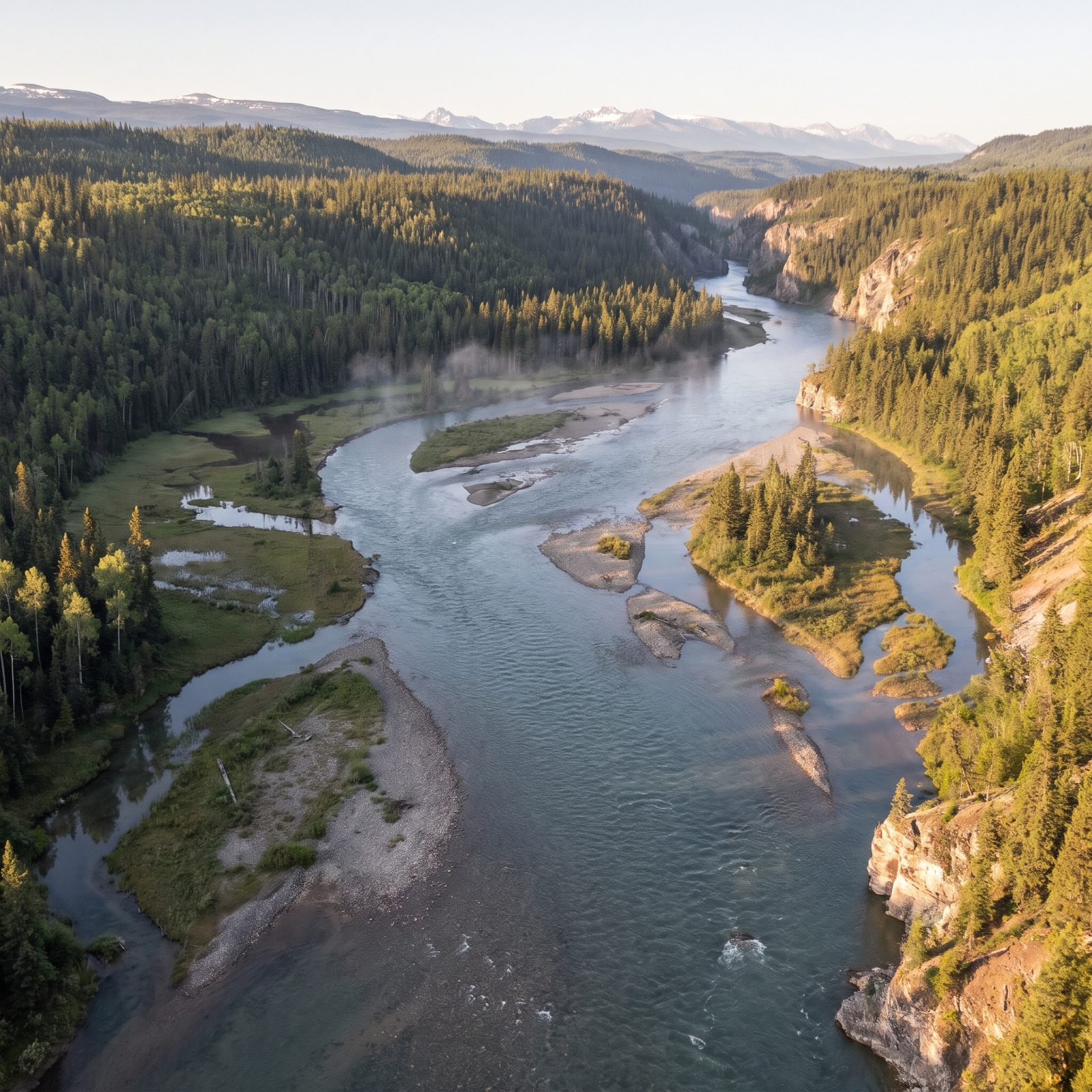
Finished in 1968, the Bennett Dam created Williston Lake, one of the largest reservoirs in North America. It flooded a valley running something like 250 kilometers up the Rocky Mountain Trench — an absurd length of drowned river.
What vanished was boreal river country: spruce forest, floodplain wetlands, and the hunting and trapping grounds of several First Nations whose lives were upended with little warning. The reconstruction restores the Peace Canyon and the braided channels threading between gravel islands, a northern river before it became a lake you could lose a small country in.
11. The São Francisco River Before Sobradinho Dam Swallowed the Backlands
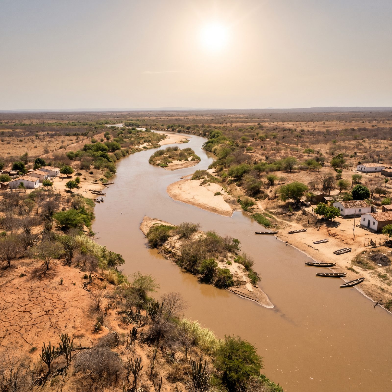
The São Francisco is the great river of Brazil’s dry interior, a lifeline threading through the sertão.
Sobradinho Dam, completed in the late 1970s, created a reservoir so large it displaced tens of thousands of people and drowned several towns outright. The river in our reconstruction is the working one — canoes, sandbanks, whitewashed villages — the river that organized life in the backlands for centuries before the floodwaters came.
10. The Tocantins River Before Tucuruí Dam Flooded the Amazon Rainforest
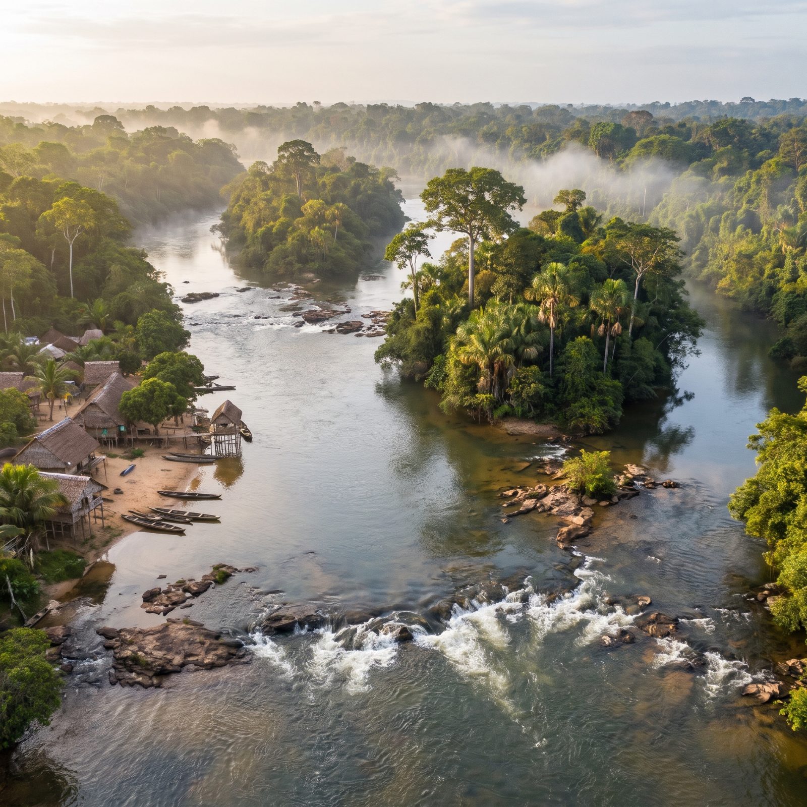
Tucuruí, finished in 1984, was one of the first mega-dams driven deep into the Amazon, and its reservoir drowned a huge area of standing rainforest.
For years dead trees poked through the still water, a forest rotting in place. Our reconstruction brings back the living version — the rapids, the forested islands, the clear river running under a green canopy. The lower Tocantins once fed local communities with rich fisheries. Then the dam cut the river in two, and the fish runs changed for good.
9. The Madeira River Before Santo Antônio and Jirau Dams Blocked Its Rapids
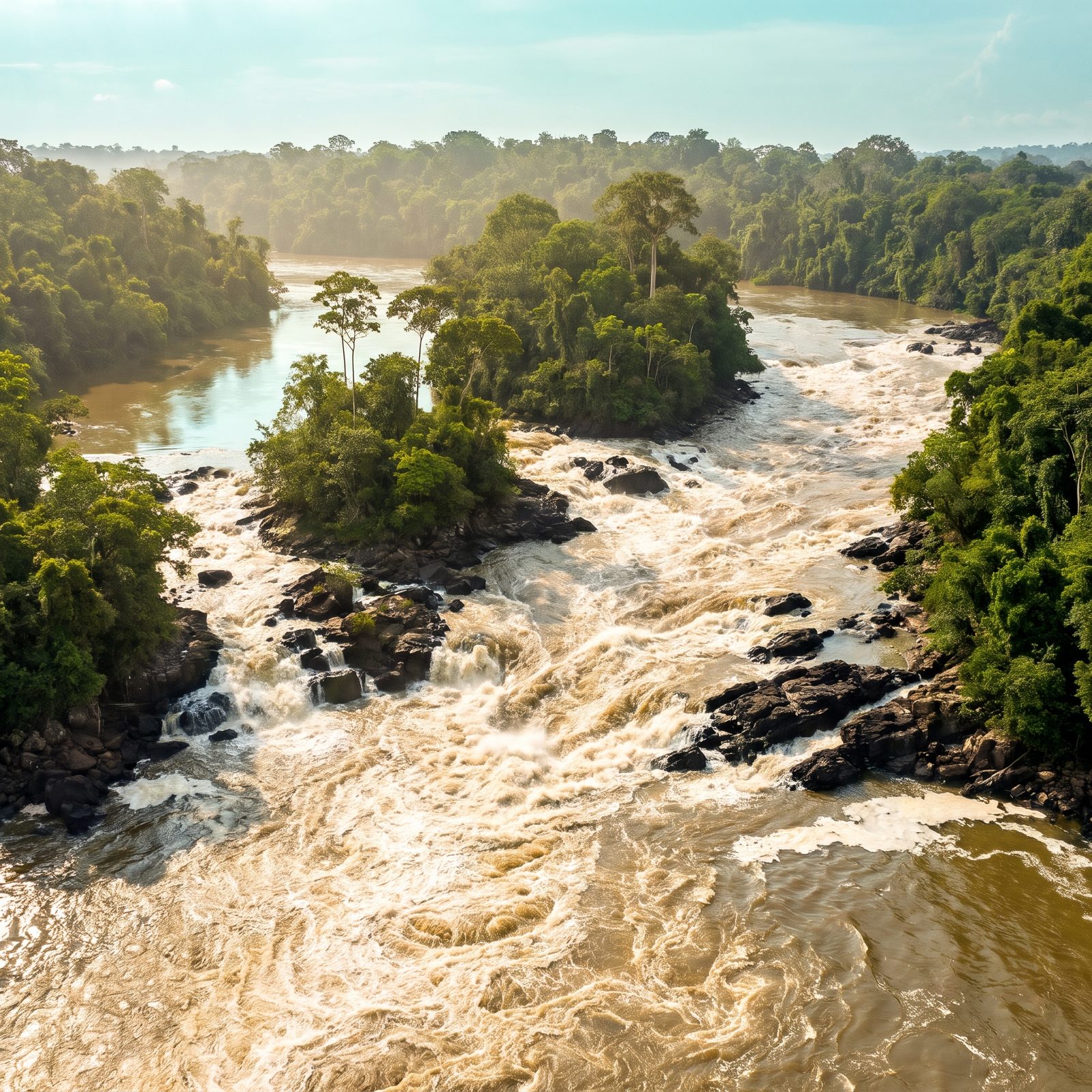
The Madeira hauls one of the heaviest sediment loads of any Amazon tributary, and its upper reach was famous for a run of wild rapids near Porto Velho.
Santo Antônio and Jirau, both built in the 2010s, turned those cataracts into run-of-river dams. Our reconstruction restores the churning whitewater and black rock outcrops the river spent ages carving. And here’s the catch: the Madeira is a migration highway for giant catfish that travel thousands of miles. Block the rapids, and you have to wonder whether those fish can still make the journey at all.
8. The Caroní River Before Guri Dam Formed a Reservoir the Size of a Country
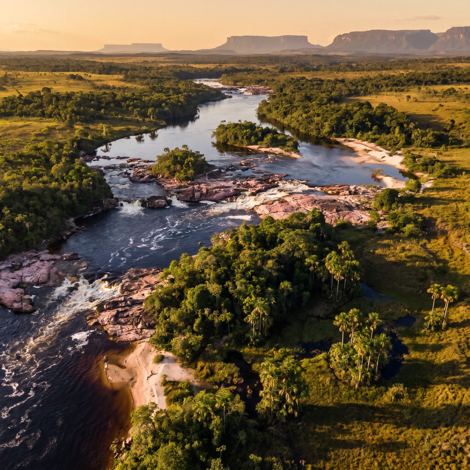
The Caroní drains the ancient tabletop-mountain country of Venezuela’s Guayana, its water stained dark as tea by tannins bleeding out of the forest.
Guri Dam, finished in stages through the 1980s, created one of the largest reservoirs on Earth and flooded a vast sweep of savanna and gallery forest. The reconstruction brings back the pink-granite rapids and the dark river mirroring the distant tepuis. Guri still supplies a huge share of Venezuela’s electricity — which means a drought that drops the reservoir can darken half the country.
7. The Bío Bío River Before Pangue and Ralco Dams Reached the Pehuenche Canyons
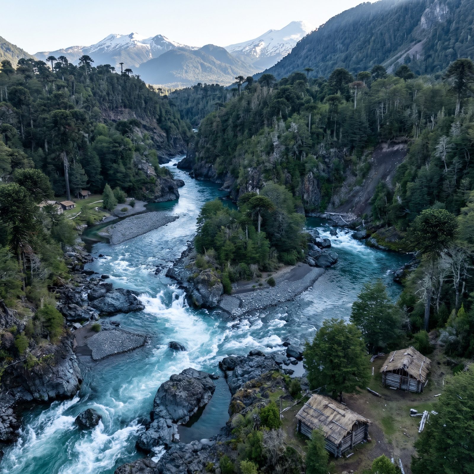
The upper Bío Bío was once a world-class whitewater river, turquoise water tumbling through Andean canyons past monkey puzzle forests.
Pangue (1996) and Ralco (2004) flooded canyon reaches that were ancestral Pehuenche land, and the fight over Ralco became a landmark case for indigenous rights in Chile.
Looking back thirty-five years to the wild upper river, a career river runner writes “A big river with big rapids in a stunning landscape; the Bio Bio didn’t need a dam threat to draw boaters from around the world.”
6. The Orange River Before Gariep Dam Steadied South Africa’s Wildest Flow
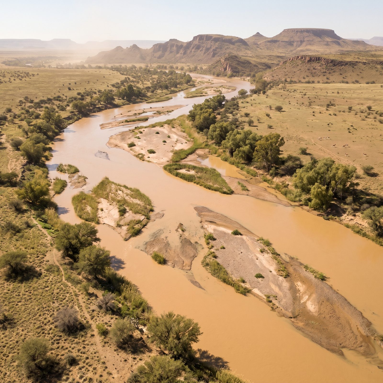
The Orange is South Africa’s longest river, famous for swinging between raging floods and a near-nothing trickle across the karoo.
Gariep Dam, completed in 1971, is the country’s largest reservoir, built to tame that wild variability for irrigation and power. The reconstruction restores the untamed channel — the sandbars, the reed shallows, the river willows standing over moving water in dry country. Before the dam, the Orange’s floods scoured and rebuilt the floodplain every single year. A reservoir erases that rhythm quietly, almost politely, and you don’t notice what’s gone until it’s long gone.
5. The Niger River Before Kainji Dam Flooded Its Rapids
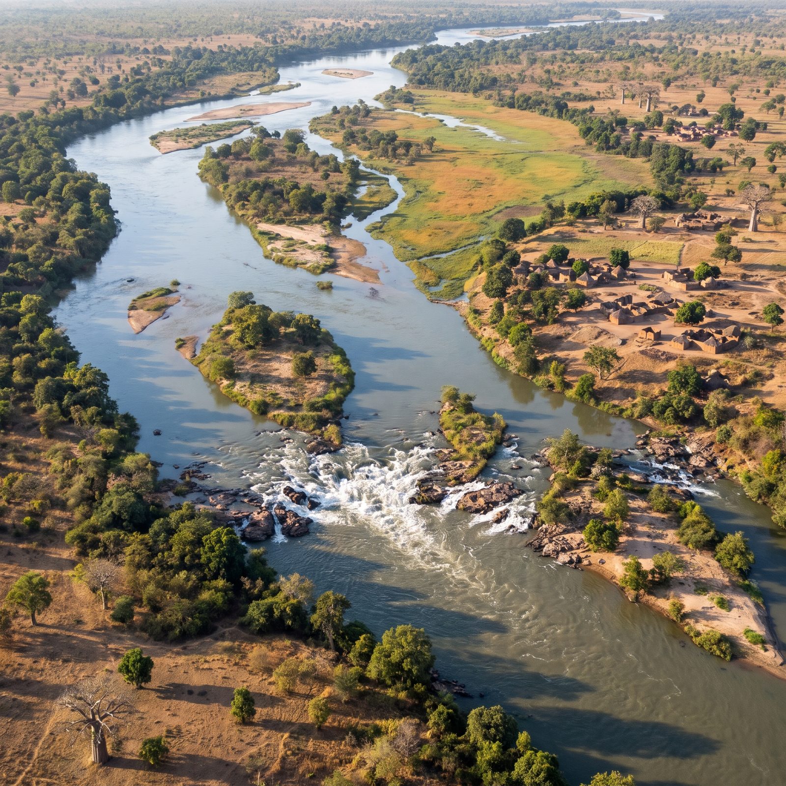
Before 1968, the Niger here did something it no longer does. It roared. For centuries the Bussa rapids shattered the river into a run of white water and rock that boats had to haul themselves around — the same stretch that the explorer Mungo Park never got past alive.
Then Kainji Dam drowned all of it, swallowing the rapids, the river-town of Bussa, and dozens of villages whose residents were shunted up onto higher ground. Our reconstruction brings back the channel as it was: braided, island-studded, running full in the dry season, with the savanna crowding right up to the water’s edge.
4. The Volta River Before Akosombo Built the World’s Largest Reservoir
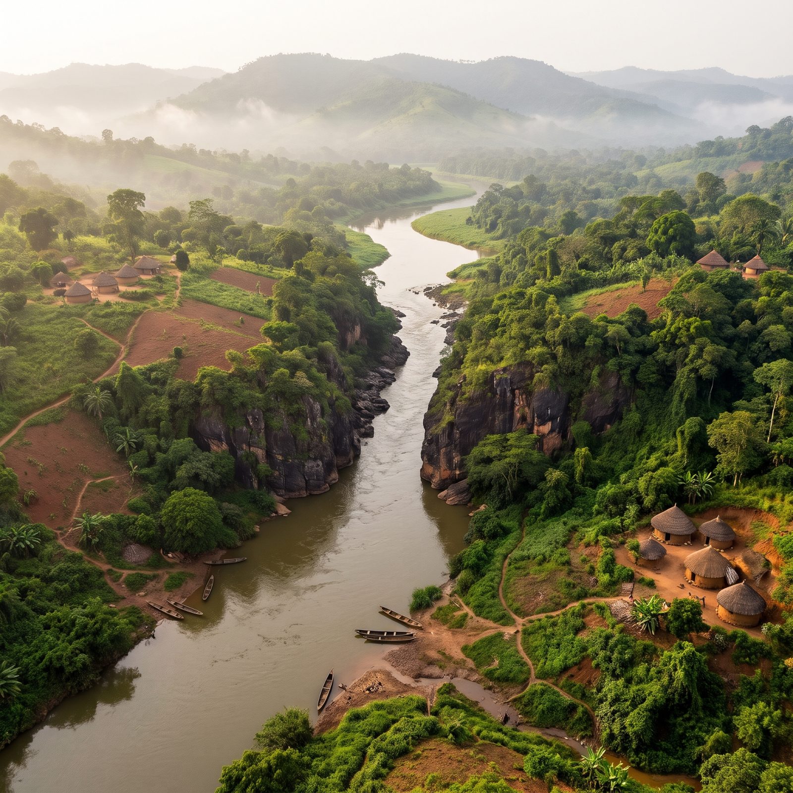
The gorge was the whole reason. Engineers picked this narrow throat in the Akwapim hills because it was cheap to plug — close one gap, and the water behind it would back up for hundreds of miles.
And it did. Lake Volta, finished in 1965, became the largest reservoir on Earth by surface area, a man-made inland sea that pushed around 80,000 people off land their families had farmed for generations. Our reconstruction shows what moved through here before the gate closed: a working channel of canoes, fishing camps and forest, threading a gorge that now sits underwater.
One narrow gorge, one wall, and a river turned into a sea the size of a small country.
3. The Omo River Before Gibe III Choked Its Flood Pulse
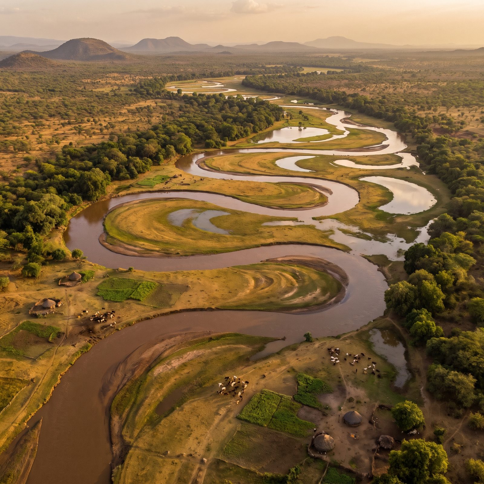
A flood can be a gift. Every year the lower Omo rose, spilled across its banks, and left a layer of silt that people planted into the instant the water pulled back — flood-recession farming, fed by a pulse as reliable as the seasons.
Gibe III, running since 2015, flattened that pulse. Now the dam hoards the water and lets it out on a timetable set by turbines rather than rains, so the artificial flood downstream no longer behaves the way the land has always expected. And Lake Turkana, which the Omo feeds, has been dropping.
2. The Blue Nile Before the Grand Ethiopian Renaissance Dam
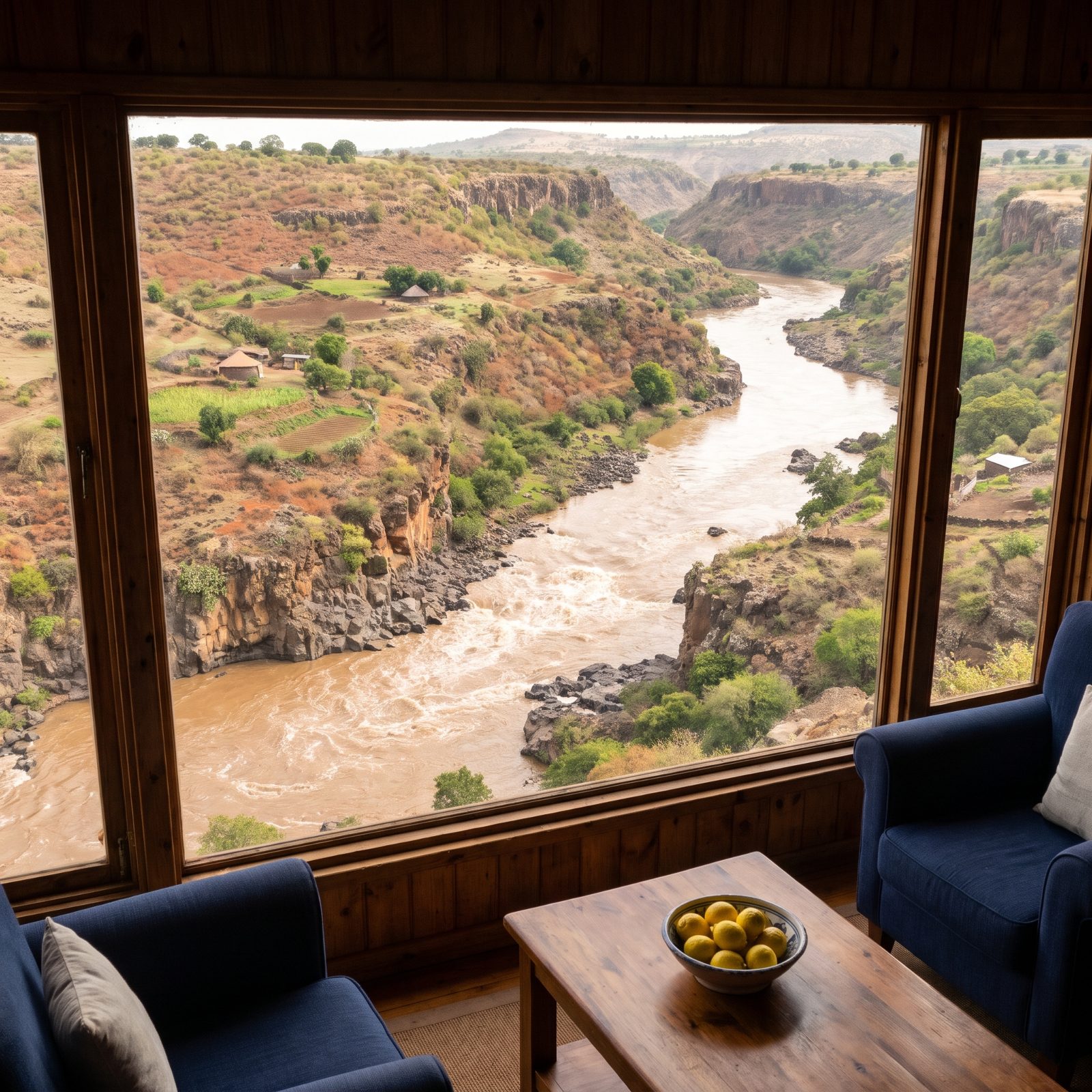
This is the river that built Egypt. The Blue Nile hauls most of the silt and summer floodwater that ever reaches Khartoum and Cairo, charging down out of the Ethiopian highlands in a brown, violent rush every rainy season.
At the gorge near the Sudan border, Ethiopia built Africa’s largest hydroelectric dam and began filling its reservoir in 2020. Our reconstruction catches the stretch before all that — fast water tearing over volcanic rock through a dry gorge, not a wall in sight. The physics of it isn’t controversial. How fast you fill a reservoir this big, and who gets to decide, is another matter entirely, and it’s become one of the most closely watched water disputes anywhere on the continent.
Here’s what most people miss: the sediment itself is contested. The silt the Blue Nile drops on its way north is pure fertility for one country and a maintenance headache for the next.
1. The Elwha River Before Two Dams Trapped Its Salmon
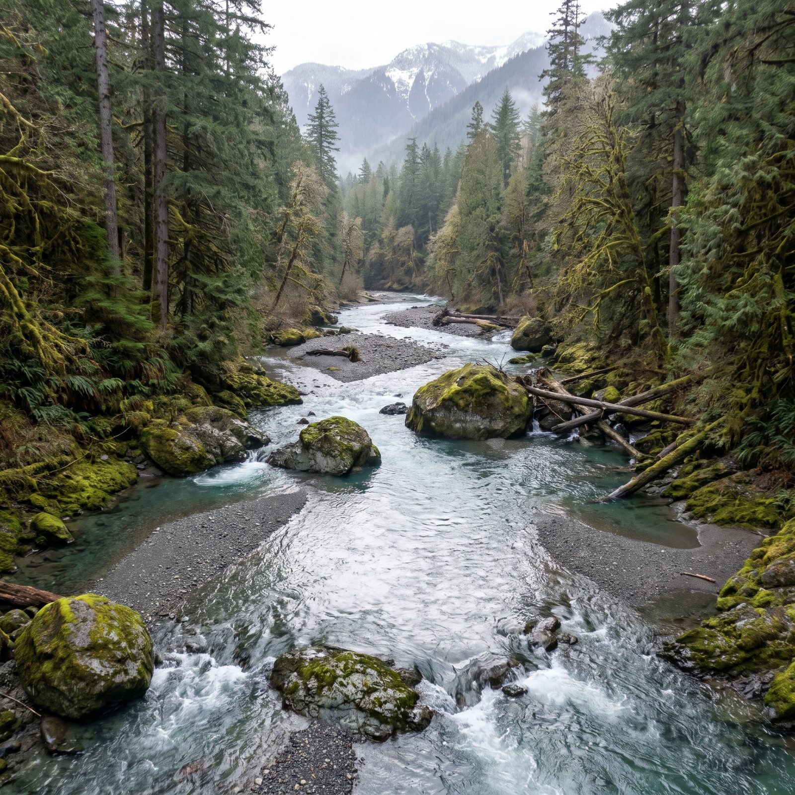
Now for the twist. The Elwha got its free-flowing landscape back.
For nearly a century, two dams sealed salmon out of more than 70 miles of pristine habitat inside Olympic National Park, penning Chinook that once ran to the sea at over 100 pounds into the river’s lowest few miles. Then, between 2011 and 2014, both walls came down in the largest dam removal in US history.
So our reconstruction does double duty. It shows the canyon as it ran before 1913 and — remarkably — roughly how it runs again today. Salmon have pushed back above the old dam sites. Beaches at the river mouth, starved of sediment for a hundred years, have rebuilt themselves out of released gravel.
After the two Elwha dams came out, a coastal hazards specialist tracking the river observed that “Salmon of all species very rapidly moved into habitats they haven’t been able to get to for 100 years”